| Sept 10/13 to Sept 18/13 | Port Hardy Port Alice Telegraph Cove |
| Sept 20/13 to Oct 10/13 | Zeballos Nootka Sound Kyuquot |
| Oct 19/13 to Nov 12/13 | Hike Horseshoe Bay to Castlegar |
Wanting to have a look at Nootka Sound I decided to bike to Zeballos. Shortly after leaving the highway that road became gravel and was in heavy logging truck use. It made for a memorable day. I don’t recall the elevation gain in crossing the divide from east coast to west but the effort expended that day was greater than either of the days crossing Rogers Pass or the Blueberry Paulson. The drag on a gravel road is much greater than on pavement which made it necessary to constantly get off and push. The truck drivers were very courteous. It was a warm day with plenty of dust but they’d slow when they saw me. Late in the day, a passing pick-up stopped. It was a logging truck driver I’d spoken to earlier and his friend. After their shift, they’d driven out just to see how I was doing. The other fellow was keen to try pedalling the bike with the canoe in tow. I was happy to oblige him and used his camera to take pictures.
Once over the top, I was lucky to make it down the steep downhills without having a ‘train wreck’. My weight on the back tire provides all the braking traction on gravel roads. If loose gravel were to cause a skid that had me putting a foot down to keep my balance, I likely wouldn’t be able to control the push from the canoe, except to try to immediately maneuver cross slope. There were a couple of dicey moments had me wishing I had made a tree drag as on the Bella Coola hill. Braking on downhills is never a concern on pavement.
Zeballos like Bella Coola gets plenty of rain, but like Bella Coola when I arrived there, Zeballos was overdue for some wet. I was looking for drinking water when I reached the valley bottom and crossed numerous dry creeks before finally being able to fill my water bottles. The dry spell ended that night though and the tent was thoroughly tested with a deluge that lasted all night. I knew the rain was coming and expected to be spending three days in Zeballos waiting for the sun to shine.

Best I could find for a campsite on the outskirts of Zeballos. The morning following a very wet and thunderstormy night.

It’s not only trucks that haul logs on northern Vancouver Island.

The federal wharf in Zeballos.

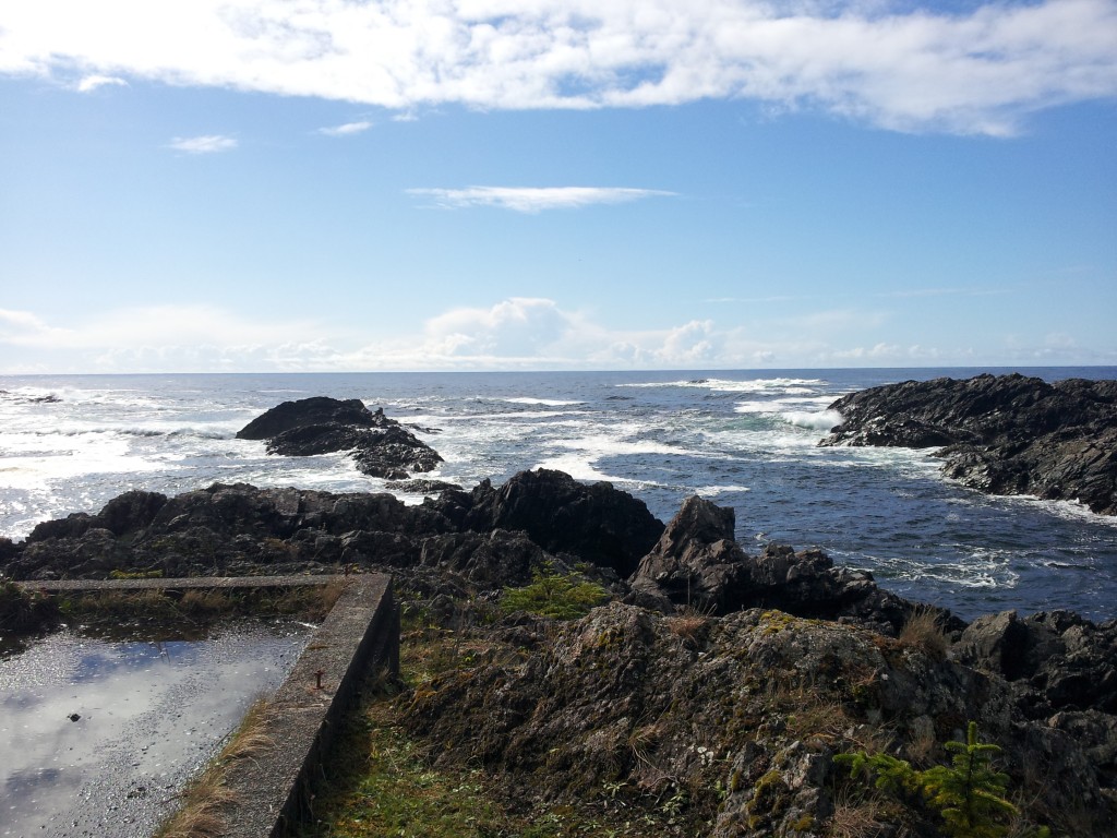
Zeballos and environs from the water.

When I arrived in Zeballos I intended to paddle south through the inside waters of Nootka Sound to Gold River harbour. That plan changed when I learned of the ‘Uchuck’, a coastal freight vessel that also takes passengers. Its nearest stop was at Esperanza, a mission camp about 20 kilometres from Zeballos. Most of my paddle to Esperanza was with fabulous mill pond-like conditions.

Nootka Island is a short distance across the channel from Esperanza. While investigating its shores I passed by what I thought was just a black stump or boulder on the shore – my vision being restricted by the setting sun. Chewing sounds made me turn and come in for a better look and the dark stump became this guy. I also spent some time using binoculars to watch a large sea lion feed on what was likely a school of herring or similar. Its feeding methods had the interest of a flock of seagulls who were very engaged in picking up what scraps they could find.

The Uchuck III. Originally built as a minesweeper it has been serving the west coast of Vancouver Island for more than 50 years. I recommend the trip to Kyuquot. You can spend one night and return the next day or do as I did and spend a week until it returns. Getwest Cruises

Being ‘scooped’ aboard the Uchuck. As simple as paddling onto a weighted pallet they lower into the water. Re-entry by the same method. Kayakers make frequent use of this service. My thanks to Cathy Berger for providing this photo.

Sea otters were easy to spot from the Uchuck. Laurence of what was canadart.net was able to get this photo of an otter with what appears to be an octopus.

When we arrived in Kyuquot I asked the boat crew if they knew of any nearby camping spots. They didn’t, but mentioned kayakers sometimes slept on the dock. This seine net drum served my needs and my improvised shelter kept me dry despite the rain during the night.

En route to Spring Island to spend a week a la Robinson Crusoe waiting for the Uchuck’s next week’s return. Japan dead ahead some 7000 kilometres … should I try for it?

Japan will have to wait. Not enough time this day.

This camp area is used by a kayak adventure company westcoastexpeditions.com during the summer months. The amenities I was able to make use of made my stay more enjoyable. There were three days of heavy rain followed by three days of sunshine.
This cement foundation is all that remains of a sentry hut in use during WW2. Spring Island was one of many such lookout locations keeping watch on the Pacific.

A stormy day on the west coast

A wet and stormy day on the west coast.

A very pleasant day on the west coast.
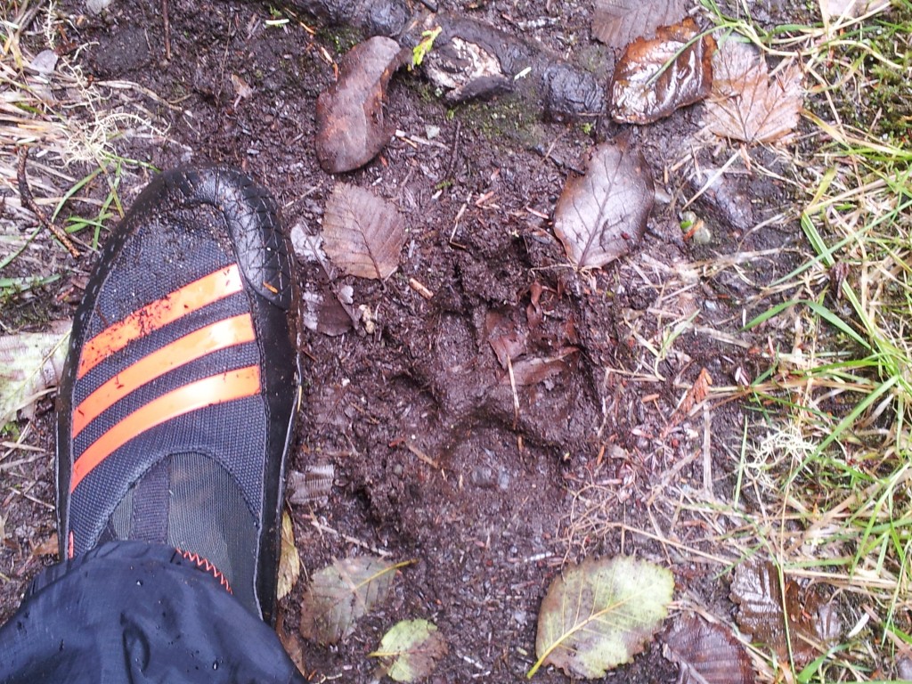
Thought this was a cougar track but it’s a wolf.

Tannins in the organic matter turn the water on Spring Island very brown almost red. Creeks that flow wine. I chose to catch and drink rainwater.

The second day I was on the island I walked out to the west side for some storm watching. I had my Spot personal locator in my coat pocket and didn’t realize the pocket zipper was partly undone. Also, I hadn’t properly tightened the back of the locator when I last installed batteries. As a result, my only means of doing a daily check-in got wet and stopped working. It was too rough to paddle back to Kyuquot to phone and I suspected that my sister might be calling the Coast Guard to report my absence. The photo is of my AOK, ‘all’s well’ message, written in seaweed should they have sent a plane out to check. On the fourth day, I was able to paddle in and phone.
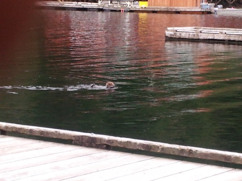
Sea otters were plentiful but timid, and not easy to photograph. This one was in the harbour at Kyuquot and less fearful of people. I have a video showing him grooming himself with his paws and then without diving using a rock to break a clam or such. I wondered how he could do that – do they have pockets? Will, indeed they do. They can store clams and their favourite breaking rock in folds inside their front feet. They constantly groom themselves to trap air in their fur which is their means of staying warm. As well their hair is extremely dense – up to 100,000 hairs per square centimetre. I had the opportunity later to examine a sea otter pelt at the Vancouver Aquarium and their coat is so dense that it is not possible to push the hairs aside to view the skin

Cameras exaggerate sunrise sunsets – it’s ‘pretty’ dishonest, wouldn’t you say?
