PreviousNext
| July 12/13 to July 28/13 | Valemount to 108 Mile Ranch |
| August 25/13 to Sept 9/13 | 108 Mile Ranch to Bella Coola |
| Sept 10/13 to Sept 18/13 | Port Hardy Port Alice Telegraph Cove |
The Chilcotin is the area on the Interior Plateau of BC, west of the Fraser River and east of the Coast Mountains. Highway 20 runs west from Williams Lake to Bella Coola on the coast, passing through small towns like Alexis Creek, Tatla Lake, and Anahim Lake. The area has special meaning to me. After graduating high school in Aldergrove I was employed as a fermentor operator at Seagrams Distillery in New Westminster. My uncle Slim Sherk was the base manager for Cariboo Air Charter in Williams Lake. Daily summer forest fire patrols over the Chilcotin were one of his job functions. Often I would come to Williams Lake and go along on these flights. I heard the fire suppression action from the ground crews and I recall one day asking Slim, “Would I be crazy to want to quit my $600 a month job and get on one of these fire crews making $300 a month?” The following summer I had a position on the first fire suppression crew based in Williams Lake and that led to my forestry career path. The flights over the Chilcotin schooled me in knowing what the country looked like from the air but I had never seen it from the ground.
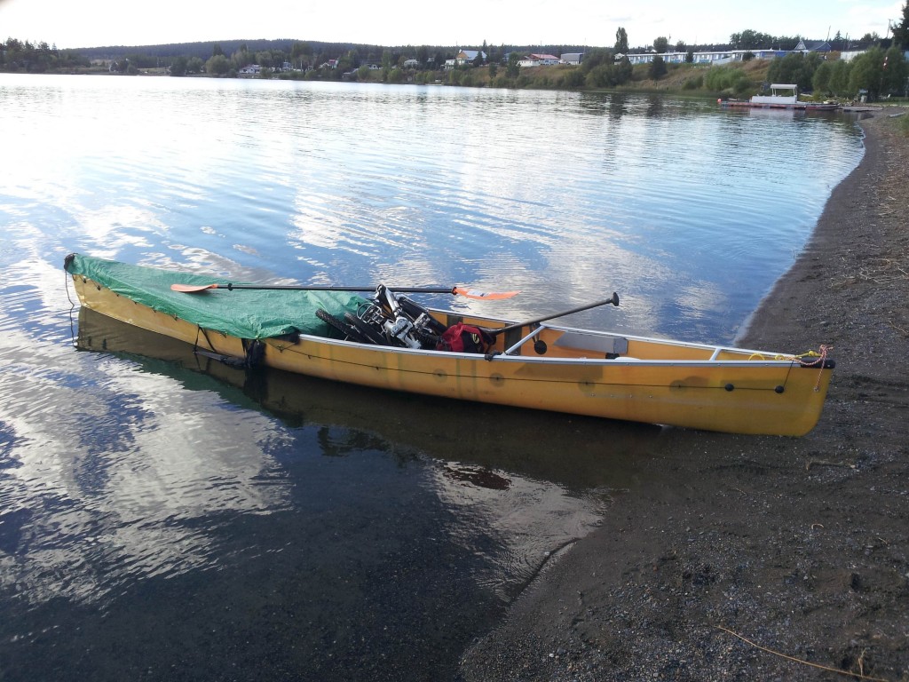
Putting in at Lac La Hache. I experimented with leaving the cart axle strapped to the bottom of the canoe, removing the wheels only, thinking this might save some time for short hops. Short-lived trial as it felt like I was paddling in molasses.

Sunset on Lac La Hache. I camped on Emerald Island with the loons serenading.

Taking out at the north end of Lac La Hache. Lac La Hache empties into the San Jose River. Que pasa avec that mix of languages?

I have a ‘Canada Maps’ application on my phone that provides a map base of 1:100,000 contour maps. I wanted to bypass Williams Lake and those maps showed a trail from Lac La Hache to Chimney Lake. A trail it was, more cow trail than road, and I had to do a lot of pushing over some very rough sections. The shirt is a birthday present from my sister, and it sums up how concerned I was about my progress over this route.

The bridge over the Fraser River on Highway 20. From here the road west climbs 600 metres to regain the elevation of the plateau. I had to get off and push for some of that climb. Creeks in the Cariboo Chilcotin are scarce and I wasn’t able to find a spring I’d been told of, that I’d find halfway up the hill. I was plenty dry when I reached the top where I asked for water at the first residence.

Looking downriver from the bridge. The footings from the pre-’60s bridge are in the foreground.
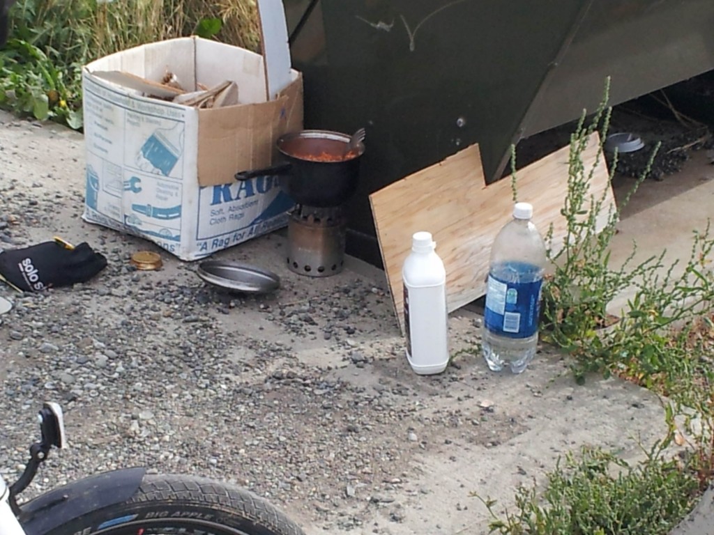
Hungry as well as thirsty, at the top, I stopped at the brake check to cook up a pot of spaghetti using the garbage container as a windbreak.

The Chilcotin Plateau. There wasn’t as much grassland as I expected, at least as seen from the highway. The more common cover was treed with fir and jackpine. Jackpine being what everyone, except a forester, calls lodgepole pine.

The Chilcotin River canyon as seen from a rest stop near Hanceville. The Chilcotin is more creek than river until it joins with the Chilco River, at which point it steals the name of that much larger river. Chilko Lake with its azure blue waters rates, in my books, as the prettiest lake in the province, although I have only seen it from the air.
Note the faint bit of black in the tree at the centre of the next picture.
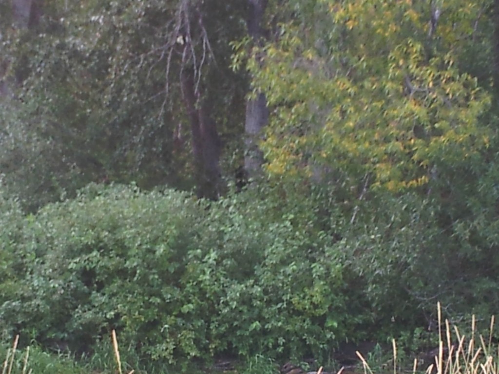
I took a gravel road west of Bull Canyon that ran along the Chilcotin River. This road rejoined the highway in about five kilometres. I camped just off the road beside the creek-sized ‘river’. While I was packing up and preparing to make breakfast, I could hear something moving about in the deciduous growth across the creek. Range cattle are common in the bush and another source of noise in late summer are squirrels dropping cones. One should not believe that every noise heard in the bush is a bear – but this one was. At some point I glanced across the creek and in plain view, eating rose hips, was a black bear about fifty feet from me. I said hello and told her she was fine where she was, hoping that she’d stick around while I got my camera. She looked at me and then went back to eating, but suddenly plunged into the brush – likely because she’d picked up my scent. I went for my camera hoping she’d pause somewhere where I could get a picture. Didn’t see her on my return, but the black spot, just visible in the centre of the picture above, is her cub which she was sending up the tree. It’s not the best of pictures, as I then had other thoughts on my mind …

I quickly loaded everything, but my tent, into the canoe and pulled it up onto the roadway where I had a good view of the creek. She came back to the water’s edge and had her front feet in the water as if she was thinking about crossing. I didn’t think she would, as by my reckoning I was no longer a threat to her cub. If she did I could have easily increased the distance between us but I didn’t want her investigating my tent. The kid in me had bought a slingshot as part of my equipment and I splashed a few rocks in front of her. With that, she disappeared into the bush and after a few minutes, I retrieved my tent.
In my forestry career, I have had numerous conversations with black bears and have never had one show aggression. I do carry bear spray and have confidence that it will do the job if ever needed. That confidence allows one to be bold when needed, and I have more than once, made black bears shy away by talking to them with the same tone one might use on an unfriendly sounding hound. A sow with a cub though is never a time to act bold – if you have the opportunity to give space. I also make the distinction between ‘bush’ bears and ‘people’ bears. The latter is used to humans. I have only dealt with bush bears. Grizzlies I hope to avoid. I have only sighted them twice, from a vehicle. I don’t know them and don’t care to get acquainted, thanks.

Haying Chilcotin style.

A first look at the Coast Mountains, just past Redstone.

Beehive sawmill burners used to be a part of every sawmill town, as was the fly ash they spread over everything. This one standing stark, in a new era, had me thinking of the junk pile in Planet of the Apes.

This is Puntzi ‘Mountain’. Not much of one at only 1365 metres of elevation. As an Environment Canada weather station, it is often one of the first locations in the province to foretell the coming of winter and report a summer frost.

Taking another gravel road so I could paddle all of Tatla Lake. Tatla Creek runs adjacent to this road and I figured I’d put in somewhere on the creek to access the lake. The creek though was more a series of sloughs, with sections too shallow to canoe, and I wanted to be sure I was close enough to the lake before putting in.

Why would I not want to put in here and paddle to the lake rather than bump along on a rough gravel road? Looks absolutely idyllic does it not? It wasn’t a smart decision – reason being

This is what it leads to, a wetland choked with bulrushes. Decision time. Faced with this do you turn around or try playing the maze game and finding a way through? Reloading the canoe onto the cart was all too familiar so I opted for the new experience.

In some places, beaver had cut canals through to open water. Not wide enough to paddle down but by either poling with the kayak paddle or grabbing handfuls of rushes on either side and pulling progress could be made. There was plenty of open water in between the blockages but had I known the rushes extended for more than three kilometres I would have been back on the road.

Swamp grass. Somewhat easier to get through than the rushes. Nearshore I could walk in the ooze. Ooze that you sunk half a foot in and in doing so released a sulphuric smelling odour. In deeper water, the rushes were matted together strong enough to support my weight.
Finally, the open water of Tatla Lake appears. The three kilometres took about six hours to get through. I’ll remember the date as it was my 64th birthday. “Have a great day Ron!” I enjoyed the challenge but was plenty glad to reach open water. Also, I likely learned something for another day when there is no option to return to a road.
I expected, upon reaching the lake, that I’d go ashore, clean up, and camp. Not so. Bulrushes lined the shore on both sides and I had to paddle until near dark before I was able to access the shore. In all of that distance, the lake was no more than three feet deep.

This is Charlotte Lake. It was recommended as a lake I should have a look at. Getting there meant 20 km of gravel road but I was glad I made the detour.

The water in Charlotte Lake is very clear and Charlotte does like to show off her bottom. To depths to thiry feet I’d quess.

As with much of the Chilcotin, the pine beetle has left its mark and the shoreline of Charlotte Lake is not as pristine as it once was.

Charlotte does have sandy sections of shoreline but the majority is bouldery rock. Oddly in many areas that rock is placed as if it had been positioned by a rock wall mason. Would like to know how the boulder depositing glaciers, or the wave action maybe, managed this.

This is the outflow from Charlotte Lake. It is the headwaters of the Atnarko River which flows eventually into the Bella Coola River. Not a feasible canoe route by any means but it’s all downhill to Bella Coola from here. One of the lakes along the way is Lonesome Lake. Recommended reading re this area is ‘Crusoe of Lonesome Lake’, the story of Ralph Edwards, who set up a homestead there with his family in the 1930s to feed overwintering trumpeter swans.

The Remarko Lodge on Charlotte Lake. It was abandoned more than twenty years ago. It was getting late when I arrived here and I was looking for a place to camp. I passed all the no trespassing signs and was going to pitch my tent on the beach beyond the private property. When I beached the canoe and stepped out I was looking at these.

These are tracks the big guy makes – Latin name Ursus arctos horribilis. See how far the claws extend in front of the toes. Note just how fresh they appear too! I had been warned about grizzlies on this side of the lake. They had me forgetting my concerns about hantavirus, and I opted for one of the Remarko cabins for the night.

A room at the Remarko. Remarkable that after all these years there is no sign of vandalism. The potential for hantavirus, spread by deer mice droppings, had me not disturbing anything. I didn’t sweep, just laid out my tarp and set up my cot. This cabin had obviously been swept sometime recently as the other cabins had plenty more mice sign.

Dive at your own risk!

Charlotte Lake sunset.

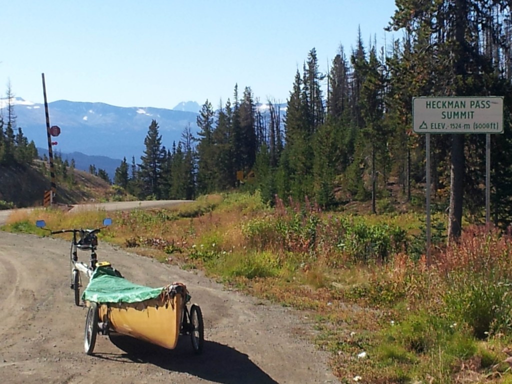
At Anaheim Lake, Highway 20 becomes gravel and climbs to Heckman Pass. The road surface was hard-packed and almost like pavement with a minimum of loose rock. This spot made for adequate camping as darkness approached.
It’s truly all downhill to Bella Coola from here. ‘The Hill’ is 20 kilometres long and has consistent grades from 8 to 12 percent with some steeper pitches. Concerns about getting the loaded 160 pound canoe down the hill had me thinking of various methods for some time. Hitchhiking everything, but the canoe, to the bottom was one possibility.

This drag, made from a limby balsam tree was the solution for getting the loaded canoe down the hill. At around 8% grades no brakes were needed. More than that required some braking and less had me pedalling.
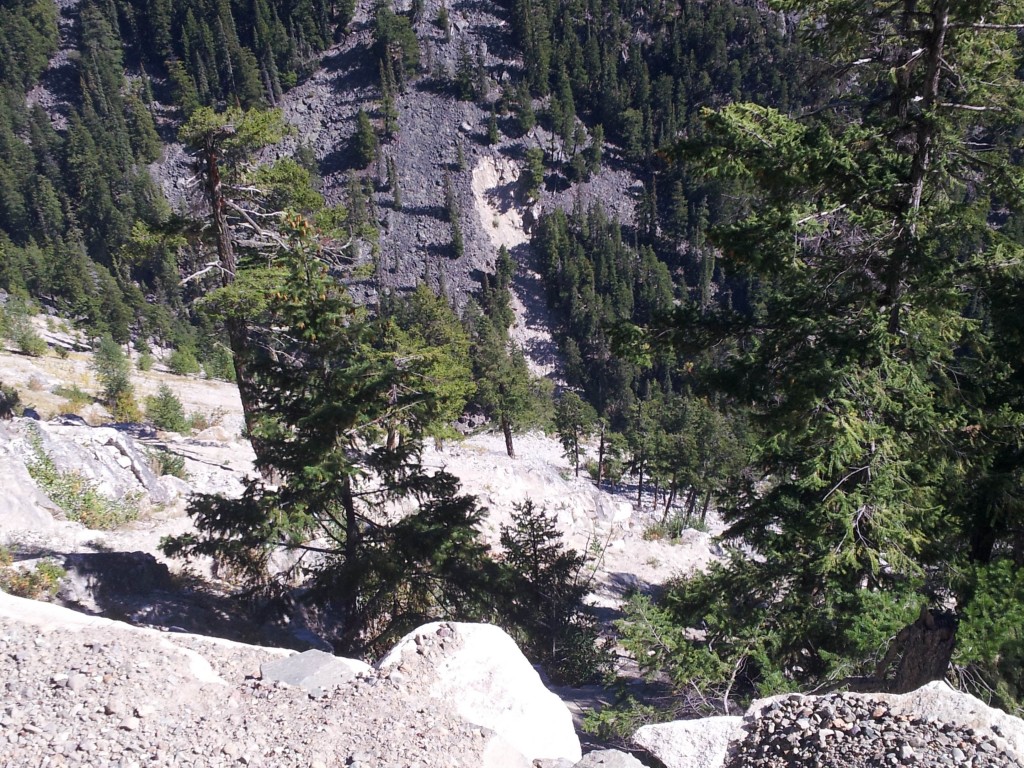
A look over the bank. With no concrete barriers, traveling this road in the winter must be a nightmare.
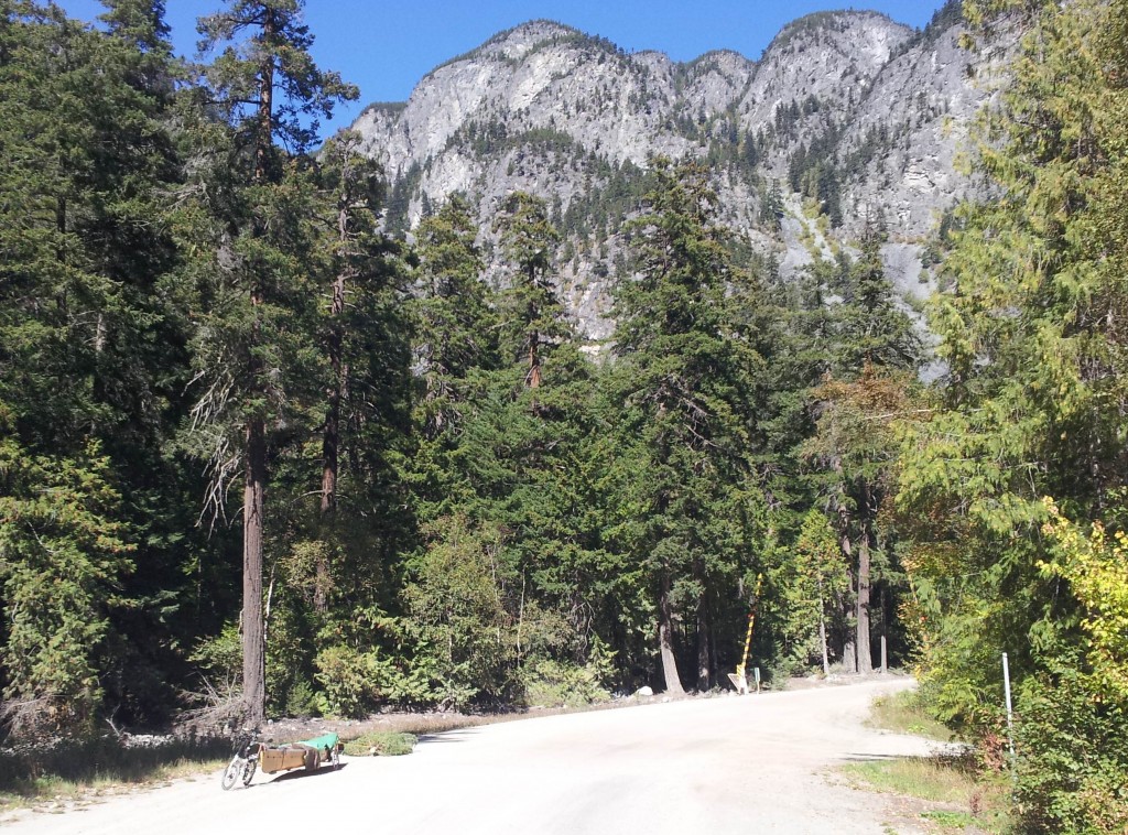
Safely at the bottom and back on pavement.

A look at the Atnarko Rive

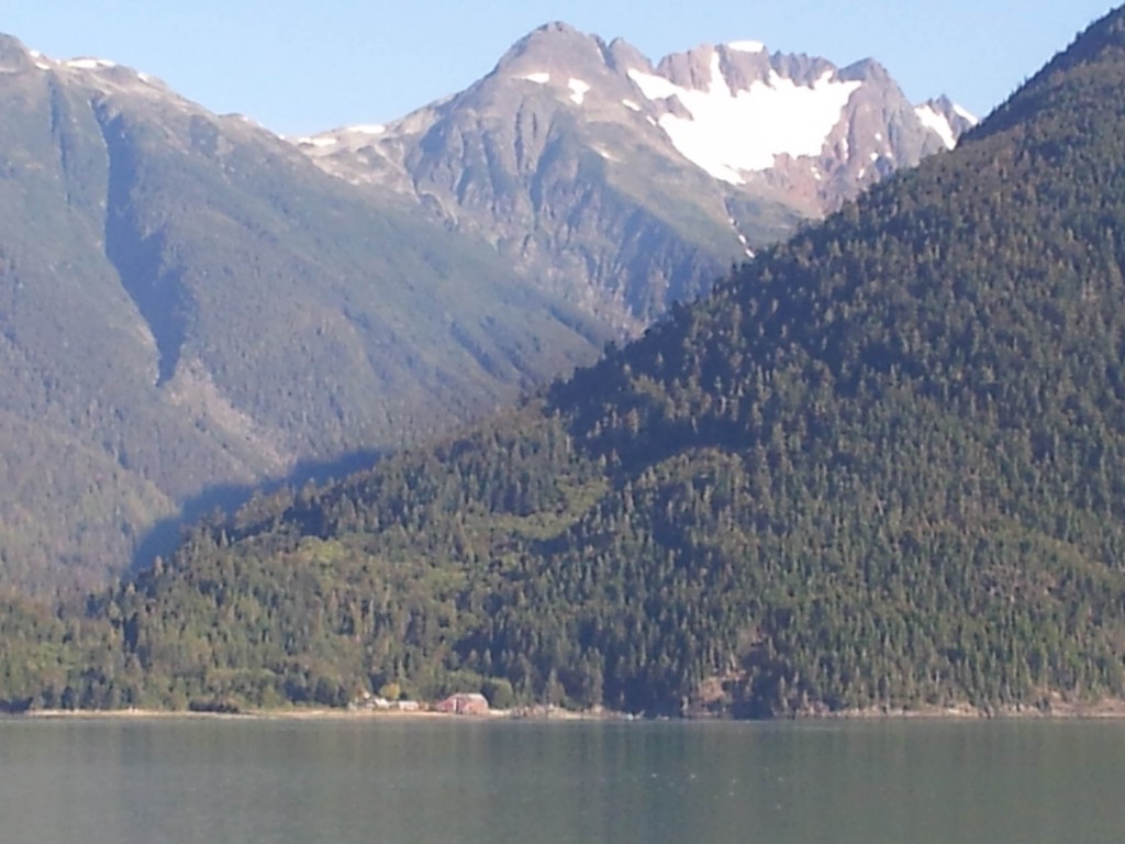
The mountains in the Bella Coola Valley are very picturesque.

Spawning and dead pink salmon.
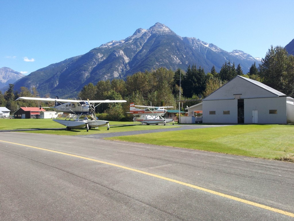
Bella Coola Air. My uncle taught, Wayne Sissons, the owner how to fly, and I spent an enjoyable couple of hours reminiscing with Wayne.

The Tallheo cannery, one of more than a dozen that operated along the BC coast from the 1900s to the 1950s. They were all put out of business when improved methods of refrigeration made it practical to transport the catch to canneries in larger centres. This cannery is located 3 km from where the Bella Coola river enters the ocean. The freshwater floats on top of the saltwater and I could taste no salt in the water.
The paddle out to the cannery was pleasant. I put in upriver about a kilometre from the inlet. Near its mouth, there were seals and eagles aplenty due to the spawning salmon. At one point a seal surfaced just metres from the boat holding a salmon in its mouth.
This was my first paddle in the Pacific Ocean and I was wary of how fast conditions might change. And change they did! I had paddled up to the cannery which is located about four kilometres up the inlet. As I left the cannery to paddle the three kilometres across the inlet, to the Bella Coola harbour area, a westerly wind soon had the ocean in whitecaps. The direction of the wind, directly up the inlet, was in my favour, but I had to diagonal across the bay if I was going to reach the wharf area. Hindsight says I should have headed back to the cannery bay as soon as I noticed the wind picking up. Once I committed to the wind though there was no opportunity to do that and the shoreline east offered no suitable places to get ashore. Smarts should have had me not out there in the first place. Reason being I had no spray skirts on the back half of the canoe. I had shipped them to Vancouver Island to lessen the weight for the bike ride to the coast. Not at all a pleasant paddle back. I kept my course on the diagonal as much as possible, turning directly downwind whenever it appeared a larger wave set was approaching. At one point I did have a wave slop over the side but only enough to get me a bit wet. After about thirty minutes I arrived on the south side, downwind of the wharf area, where the shoreline gave me enough lee to turn upwind and reach the docks. So much for lessons already learned on Arrow and Kinbasket Lakes, re giving the wind its due.


