| Nov 10/13 to Nov13/13 | Hike Midway to Castlegar |
| Mid Nov/13 to April 14/14 | Stayed put in B.C. |
| April 15/14 to May 2/14 | Fanny Bay to Port Hardy |
| May 3/14 to May 11/14 | Bella Bella to Bella Coola |
Odd that the distance paddled to Kitimat and the distance walked last fall to Castlegar are essentially the same. 718 km vs 732. The walk took 26 days, averaging 28 km per day. The paddle trip 29 days, and averaged 25 km per day. The longest walk day was 46 km vs 52 km canoed. (rowed that day) However, the canoe trip up the coast actually took forty calendar days with five days being spent wind-bound and six spent as lay-over days for one reason or another.
Although paddling is physically easier than walking, that’s not the case mentally. I call the risk of a particular situation my ‘degree of concern’ on a one to ten scale. Hiking on trails doesn’t even make the scale. Perhaps concerns about not finding water or running low on food might make a one or a two at times. A face-to-face with an aggressive bear would be an eight but there should be no concern about the possibility of meeting one given how rare it would be. Too often, the ocean had me in the five to seven range on my ten scale. Those situations could have been avoided by paddling only when it’s safe to do so. But safe to do so conditions wouldn’t include being out there in borderline conditions where a little more wind has things upped to the ‘getting dicey’ stage. If you paddled only in light ripple or better conditions you would spend more days on the beach than on the water. The same goes for waiting to hear a marine forecast for light winds only. Those forecasts almost always included a wind warning. The boat, though, did handle rough conditions very well. I never had a wave that made me think ‘that was close’ regarding the chance of tipping over. But there were plenty of times where conditions worsened and going ashore would have been the choice, except there was no suitable place to take out due to rocky shorelines. Those conditions required full attention to the approaching waves, with the kayak paddle in hand, (rather than the canoe paddle) with strong strokes applied in a manner to counter the wave action. Always a relief when eventually you tucked around a corner into conditions that offered shelter from the waves. I did always paddle with a dry suit but mine can be worn with the headpiece in ‘standby mode’, whereby it could be pulled over the head and zipped up to make the suit waterproof when necessary. Too many times though I’d not be zipped in before conditions got too rough to do so. I eventually evolved some strict rules regarding when the neckpiece was to be zipped up.
Lake waves get bigger as the wind increases but are fairly consistent in their form. Not so ocean waves. They are chaotic being affected by winds, tides, swell, and deflection off the rocks.
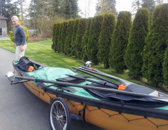 First steps April 15th, 2014. The ocean was walking distance from where the canoe spent the winter. Bike stowed along with a month’s supply of food.
 On my first day, I reached Goose Spit in Comox. The winds were increasing and I had no choice but to stop here. This picture was taken at first light the following morning. The winds were light and I hoped to get around Cape Lazo before they increased. As it was, by the time I loaded the last items, the wind was blowing hard enough that I couldn’t even launch. The north side of Goose Spit is totally sheltered and, had I known I’d be wind-bound here for two days, I would have paddled there the previous night. That’s a dry suit I’m wearing and with the beach being gravelly I thought I’d try wading into the surf and just pull the canoe along to reach the sheltered waters. It worked well enough, for about half a kilometre but then I could see that the waves ahead were breaking sooner, and keeping control of the canoe was going to problem. Sure enough, those waves started washing right over the boat. I had no choice but to let the waves wash the boat onto the beach and then struggled to pull it far enough up to get it above the surf. Not a good start to my journey. Five or ten gallons of water washed in under the spray skirt, where the oarlocks prevent them from sealing tight to the gunnel so it was an early test of the waterproof bags most of the gear is stored in. What wasn’t in dry bags got wet. My only option was to unload the canoe, get the wheels under it, and portage everything a kilometre further down the beach. The beach sand made pulling the canoe difficult and all the gear had to be carried by the only mule. It was a good three hours before I had everything moved to the lee side of the spit.
 Not a bad place to spend a day wind-bound. But I didn’t like the prospect of getting around Cape Lazo when the winds were coming from the southeast. The shoreline there runs northeast for seven kilometres. My course would be perpendicular to the direction of the waves and looking northeast I could see only rock bluff, not beach. The following day I chose instead, to paddle to a wharf in Comox, where I took out and hooked up the bike. It was a twenty kilometer ride north to Kitty Coleman beach where the shoreline ran the same direction as the prevailing winds. The problem was how much extra weight I had, compared to what I usually bike with. I not only had the seventy pounds of gear normally shipped ahead but also a month’s supply of food. Way too much weight for the cart but it survived and luckily no big hills either.
The next day I prepared to launch from the campsite at Kitty Coleman. By the time I was ready the tide was at its lowest and turning. But then the wind changed too, and in no time it was too rough. Now the issue became pulling the loaded boat back up the beach ahead of the rising tide. This beach was plenty rocky and driftwood was required under the hull to protect it. After about an hour, with heavier waves than I liked, I was able to get underway. I only went a couple of kilometres around the next point and called it a day as it was too rough. I was wind-bound at this beach for the next two days.
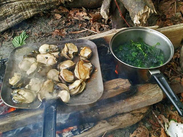 This too was a good spot to be wind-bound. A beach frequented by the locals for its oysters. Some seaweed that I call dulce in the pot. From this beach, I saw my only orcas. Not much of a sighting as they were moving very quickly and I only saw their large triangular dorsal fins.
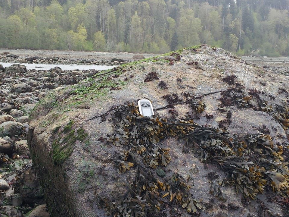 Why a picture of my GPS unit on this rock? Because this rock is on my GPS unit. I mean it shows on the map as a submerged hazard! And the chip with the map covers the coast of most of North America and no doubt shows umpteen thousand similar rocks. Imagine the early cartographers like David Thompson. with their sextants and hand-drawn maps. trying to get their head around a future where mapping would show such infinite detail – all on a fingernail-sized chip. The unit was invaluable to me for navigation, as well as indicating hazards, plus it logged my daily travels.
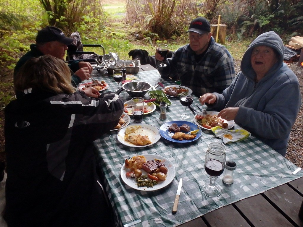 Late in the afternoon, on the day following my two day wind-bound layover, I was once again caught in rougher conditions than I cared to paddle in. No landing places, however, so no option but to keep going until one was found. Finally, I rounded a corner into a bay and could see a steep pebbly beach ahead. As I made for it, four people appeared and came down to the water’s edge to assist me with my landing. The waves breaking on the beach were only about a foot in height but I must always land stern first, so at some point, the hull has to be broadside to the waves, and a slopping one foot wave acting on the full hull is a lot of force. At the precise right moment, I swung the bow parallel to the waves, stepped onto the beach, grabbed the stern, and with the assisting extra hands the canoe was safely out of the water. A perfect landing. The foursome was preparing to eat what they’d caught that day and kindly invited me to join them. A wonderful meal that even included a glass of wine. It was then necessary to pull the canoe to above the overnight high tide mark. The eldest of the four, a gentleman in his mid-seventies volunteered to help. Curious to know what they thought when they first noticed me making for the beach in the white-cap conditions I asked what was said when they noticed me. He replied we said, “Here comes a (expletive) idiot in a canoe!!”
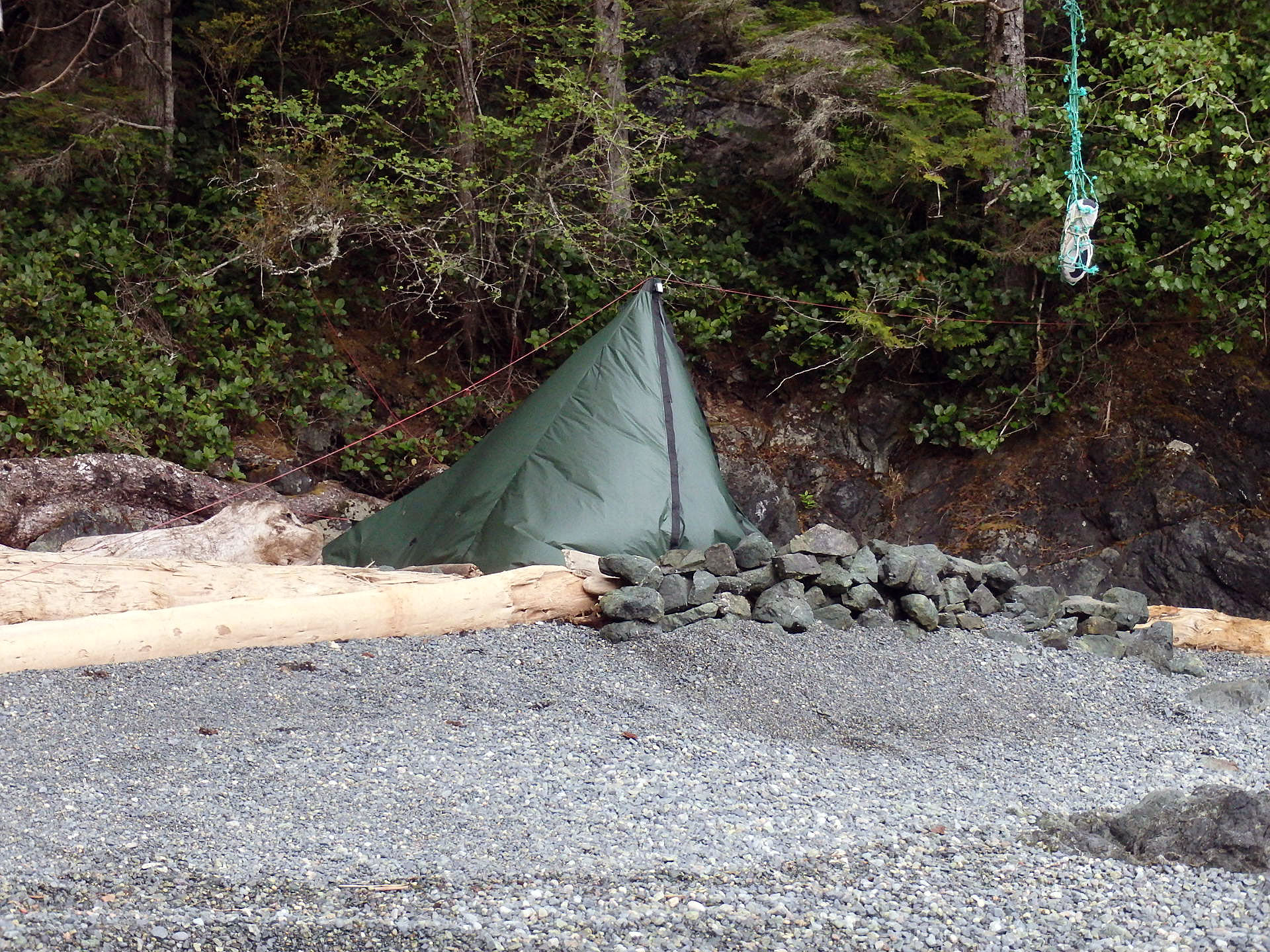
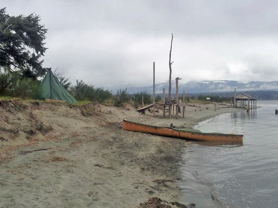
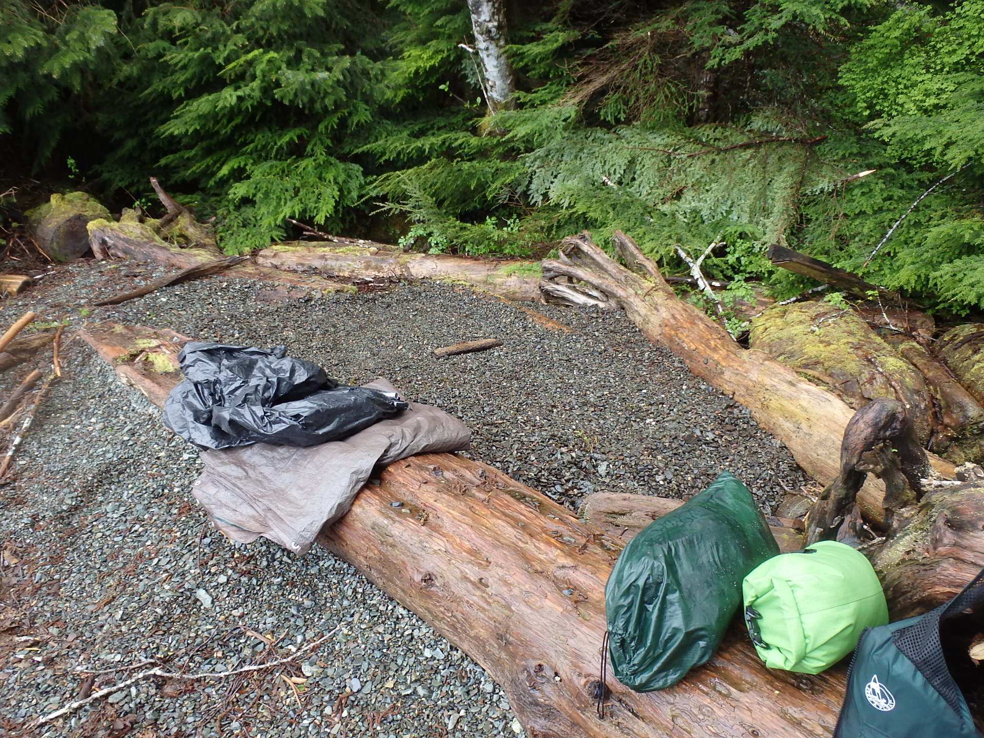
 Flattening out the beach to make a tent spot. Finding camping spots above high tide was not a simple procedure. Usually, I was able to make a spot like this one but on the full and new moons, the tides are at their extremes, and twice I had water coming into the lower side of the tent. On another occasion, I was forced to move everything out of the tent till the tide turned. My tent has no floor and that’s a plus in that only the bottom of the walls get wet. No floor is also an advantage when the tent is bigger than the available tent space as in the above picture. The tent fit over the log shown in the rear with no stretching of a floor necessary to accommodate it. Looking at this picture also reminds me that I slipped and fell on one of these logs. No harm done but after that, I avoided stepping on any wet wood if it could be avoided.

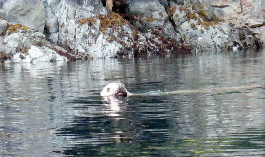 A sea lion giving me a closer look. They are not as timid as seals and their size, along with their loud guttural bark, made them intimidating at times although I knew they were harmless.

 Most mornings the tent would be wet and I would wait until the afternoon to dry it and any other damp gear. This was one of many combo lunch and dry-out stops. Pebbly beaches, allowing easy beach access, like this, were more frequent in Georgia Strait. Further north they became non-existent.
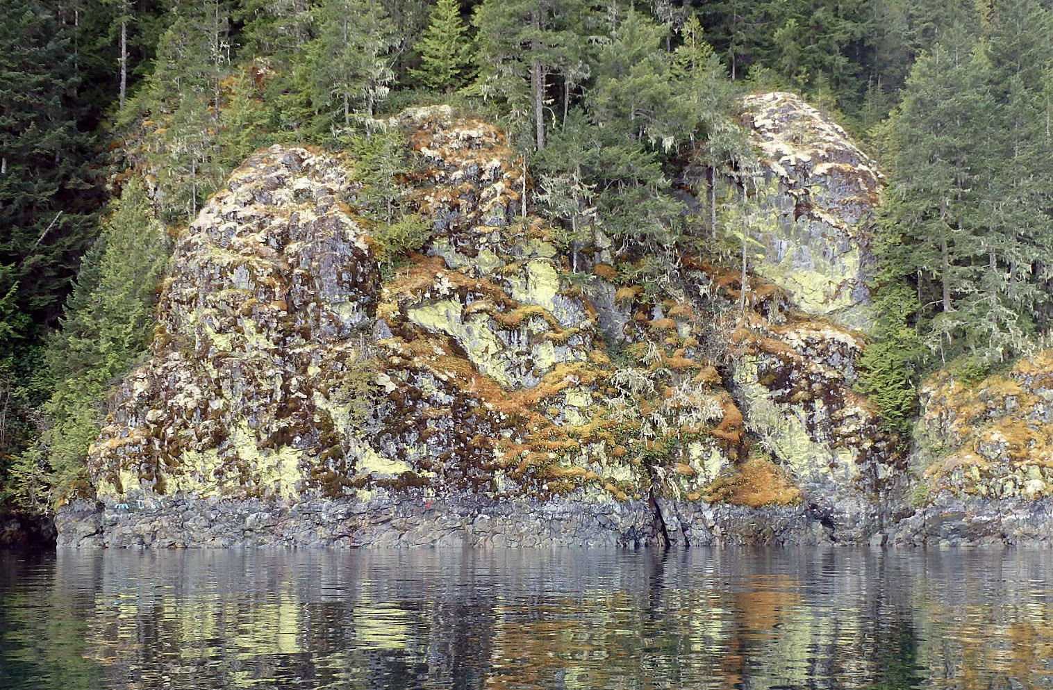
 I figured you’d be lichen this one.

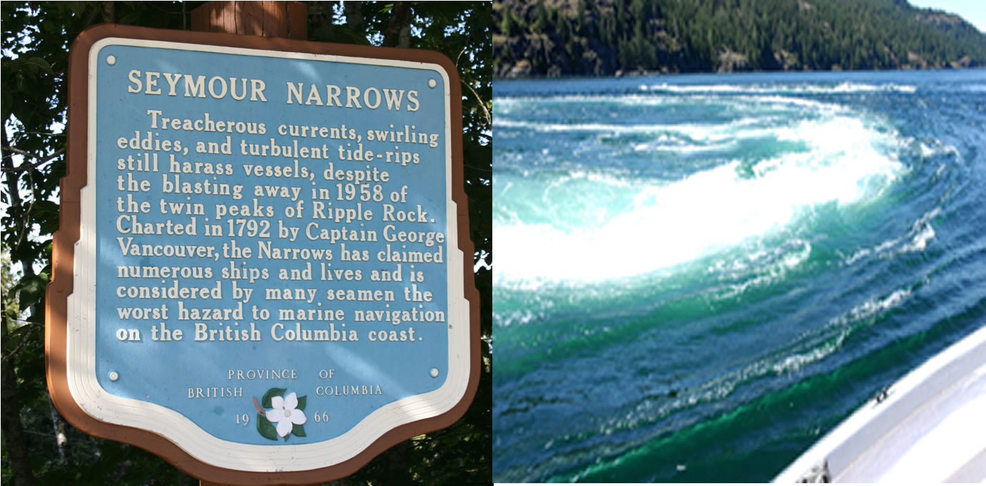
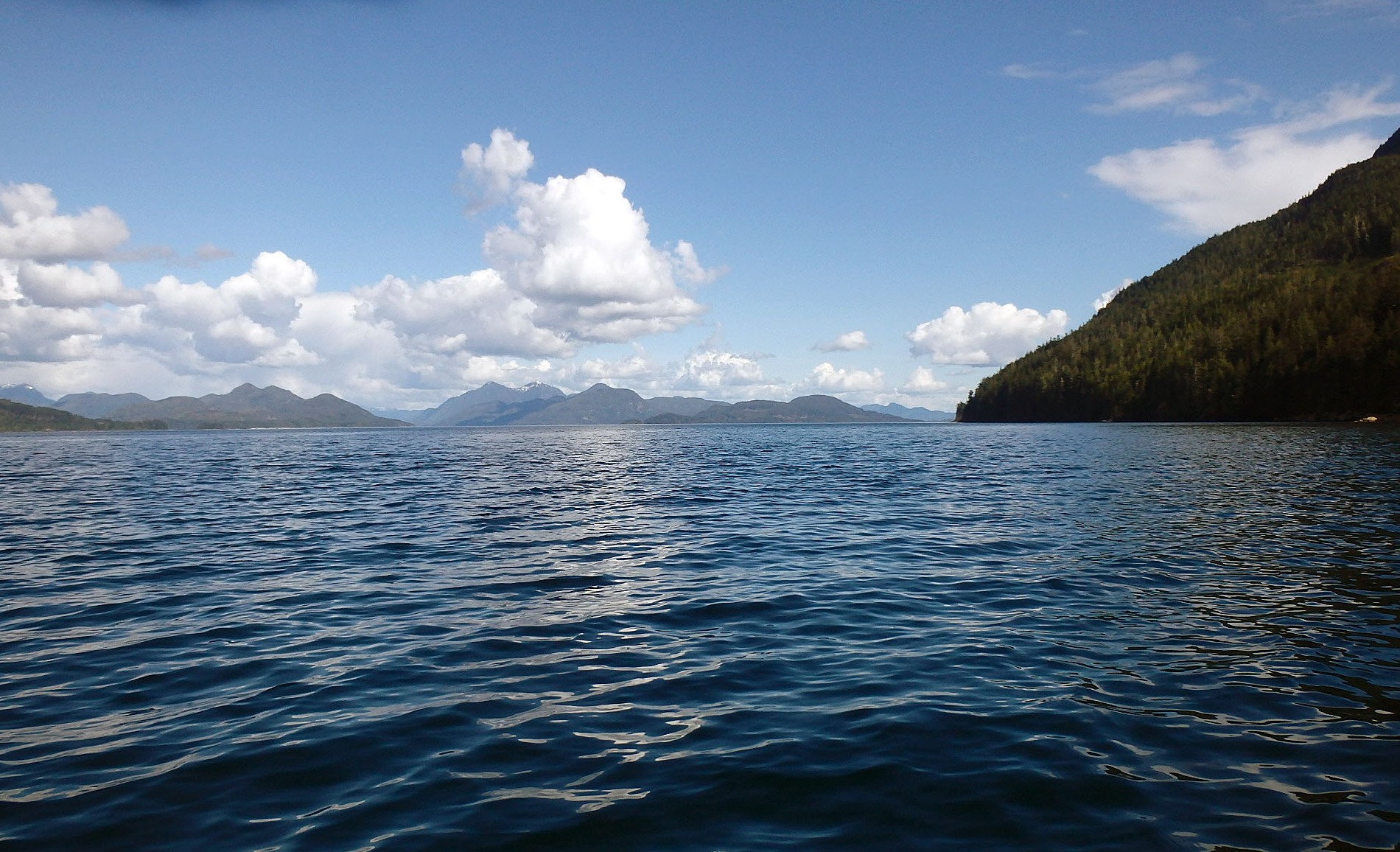
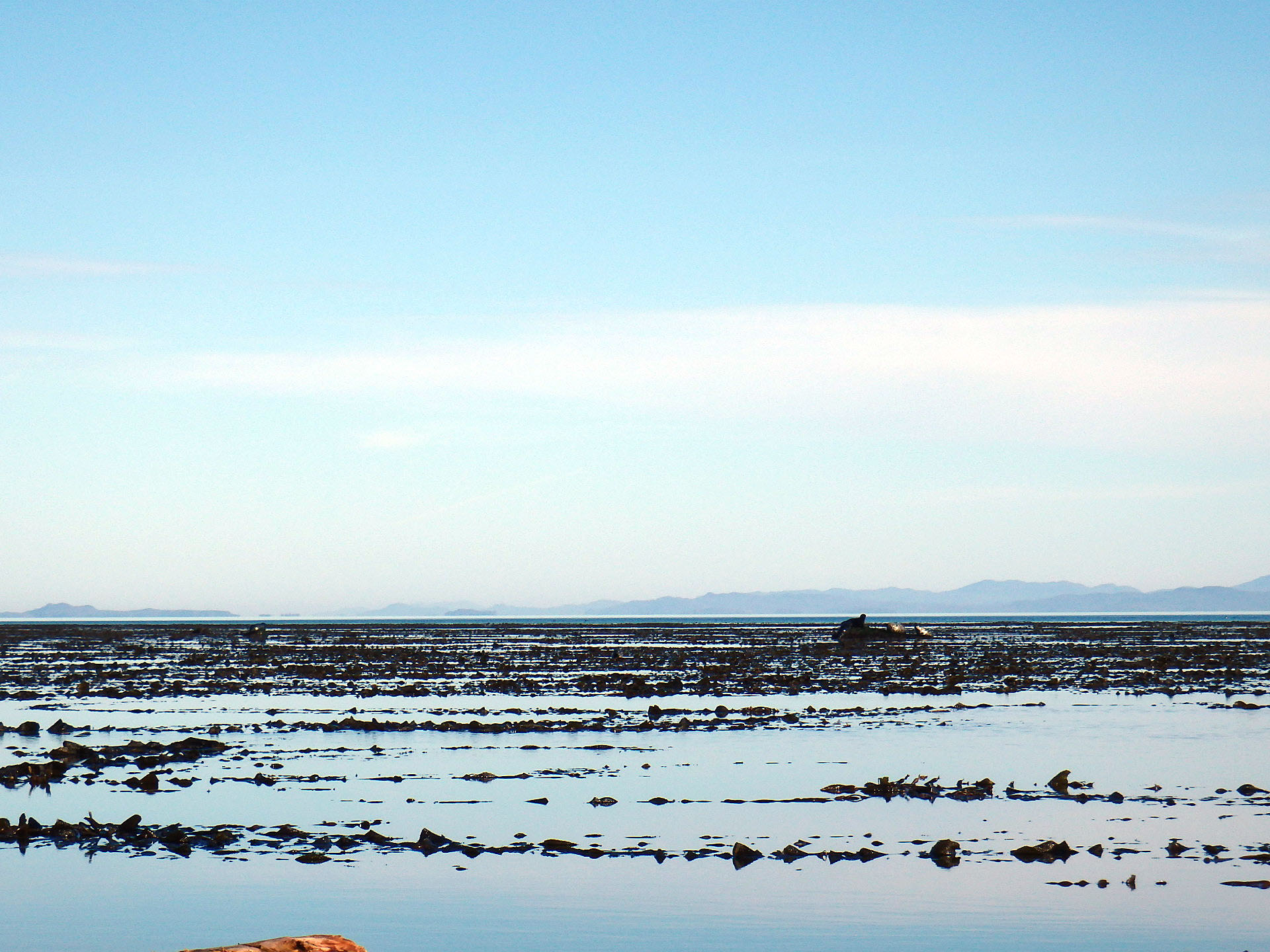
 Quadra Island with Quathiaski Cove in the foreground. I stopped here for groceries and it was familiar territory as I’d spent a few nights on Quandra when I traveled down Vancouver Island the previous year. This is Discovery Passage which has strong tidal currents but nothing like the those of Seymour Narrows that it leads to. Noon of the next day was high tide, a safe time to get through Seymour Narrows. I wanted to get as close as I could to the Seymour entrance before dark but the currents were running against me in Discovery Passage. With the help of back eddies, I was able to work my way north from the cove. I made it to Gowlland Island at the top of the above picture but in trying to follow its shoreline north I met my match with the strength of the opposing tidal flow. The flow was running at 7 kph and that’s my top speed with the kayak paddle. Once I was fully in it I paddled my hardest but a glance to the shore told me I was going nowhere. Holding my own was the best I could do. I let the flow push my back to quieter waters and went ashore for a half-hour before trying again. No joy on the second try either, and with daylight fading, I had to find a place to camp. All the beaches in the area are private property so I had no choice but to camp on somebody’s beach, and I don’t like doing that. Turned out no one was home though and legally private property does not extend below the high tide line.