| May 3/14 to May 11/14 | Bella Bella to Bella Coola |
| May 12/14 to May 26/14 | Ocean Falls to Kitimat |
| May 28/14 to July 3/14 | At friends in Terrace, B.C. |
| July 3/14 to July 22/14 | Kitimat to Hudson Hope |
The 328 kilometre paddle to Kitimat took fourteen days. For eight consecutive days, I didn’t see anybody other than occasional distant boats. My previous ‘no human sighting’ record was four days. Going even one full day without having somebody come into your view is difficult – try it. Bella Coola was my last supply point but I had no shortages.
Travelling with minimal planning and no schedule is my preference. All that’s needed is an endpoint, with no time limits, and the rest is ‘no matter’. Whatever route I was intending to travel to Kitimat I changed somewhat, after conferring with the crew on the ferry to Ocean Falls. The skipper invited me to the bridge and they got out the charts and offered their suggestions. There were two very narrow passages I wasn’t aware of and I changed my route to include these sections of less travelled waters.
 To me, it is very odd that BC Ferries provides service to Ocean Falls. The former pulp mill town of thousands now has a population of only a couple dozen people. Even odder, the ferry is required to travel the 12 kilometres up Cousins Inlet even when they know they have no passengers inbound and radio communication indicates there are no outbound passengers or freight.
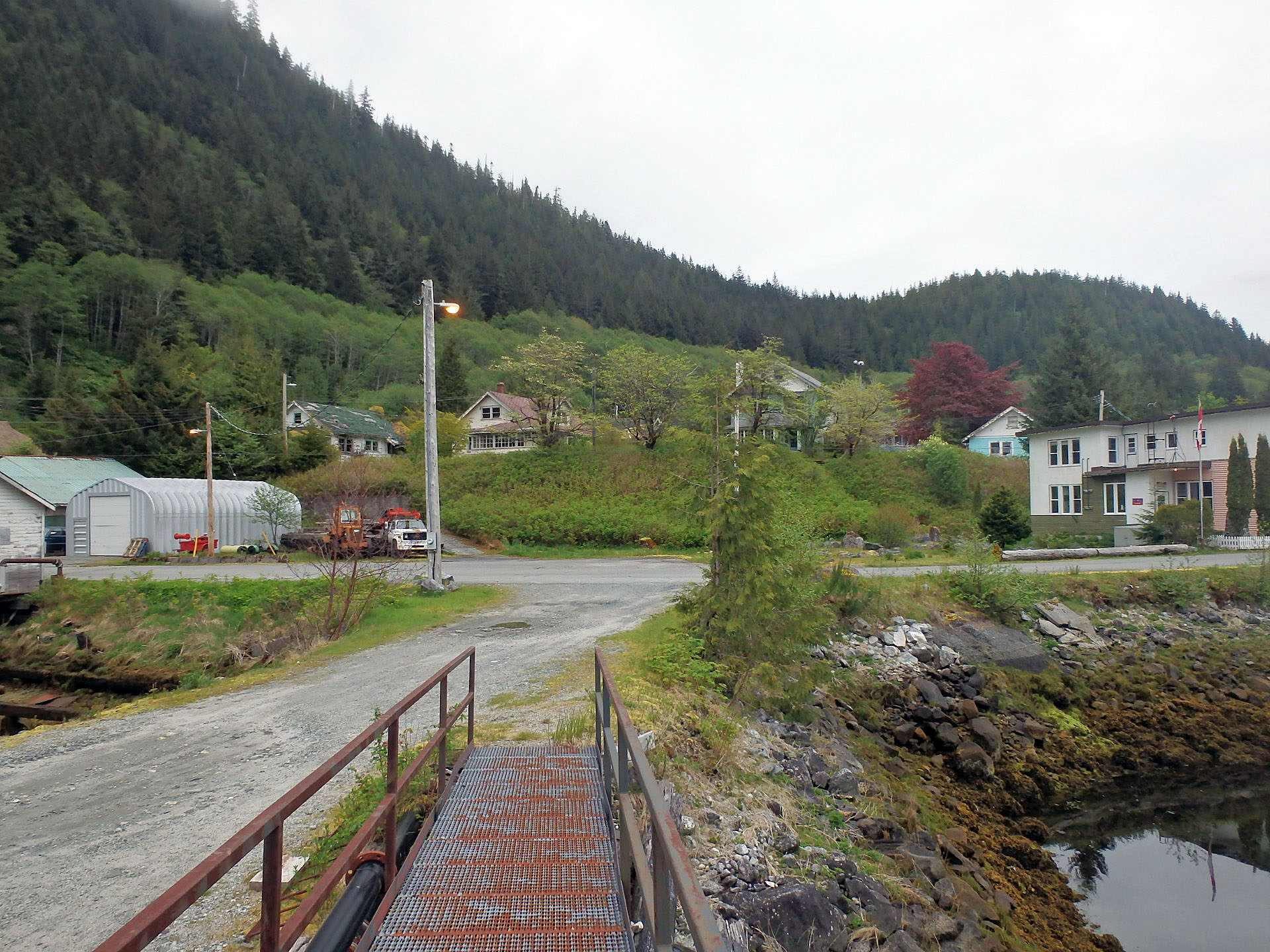
 A thriving industrial town until 1980 Ocean Falls now is a ghost town. The hotel in the background is derelict and boarded up as are a few houses that escaped demolition. The hydro dam that provided power to the pulp mill is still in operation and provides power for Bella Bella, Shearwater and other small communities.
 The few rotting houses in the distance escaped demolition. The hillside in the background, now overgrown with deciduous vegetation, was all community housing since demolished. The residents now live a few kilometres away from the town centre at Martin Valley. More info on Ocean Falls with this oceanfalls.org site.
 The closest RCMP office is in Bella Bella, but should they be required in Ocean Falls a vehicle and office await.
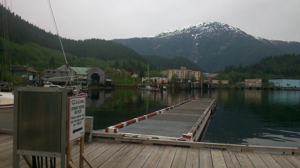 A portion of the federal wharf. Ocean Falls attracts live-aboard boaters during the summer and the docks fill with upwards of thirty boats. Early June, however, the tourist population consisted of me alone. One of the locals suggested I stay in ‘The Shack’, the recreation room built on the docks for the use of the summer boaters. Unsure that this would be OK, based on the permission of one resident only, I asked a couple of others if indeed this would be acceptable. With their assurance I moved my gear, intending to spend two nights camped in the room. No one came into the room that day but the next morning a new face arrived – the local designated as the harbour master. My occupancy of the building was not acceptable to him and he made it clear that he was THE authority when it came to the docks. This fellow was only Jerk #2 on my entire trip. (Jerk #1 was the park official in Roger’s Pass who stopped me on the highway and arbitrarily decided that the canoe and bike were a hazard because of their length.) I packed up my gear without dispute, as I certainly didn’t want to be the cause of any communal rift. My second night was spent in the BC Ferries office. A vacant one-room building with a table and chair but nothing else. By nothing else, I mean nothing else – save some dust.
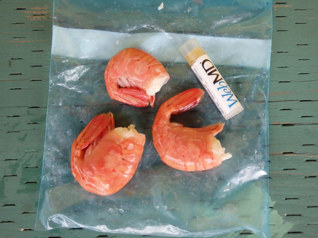 The last of a much appreciated bag full of these cooked beauties given to me by one of the locals before I departed Ocean Falls.
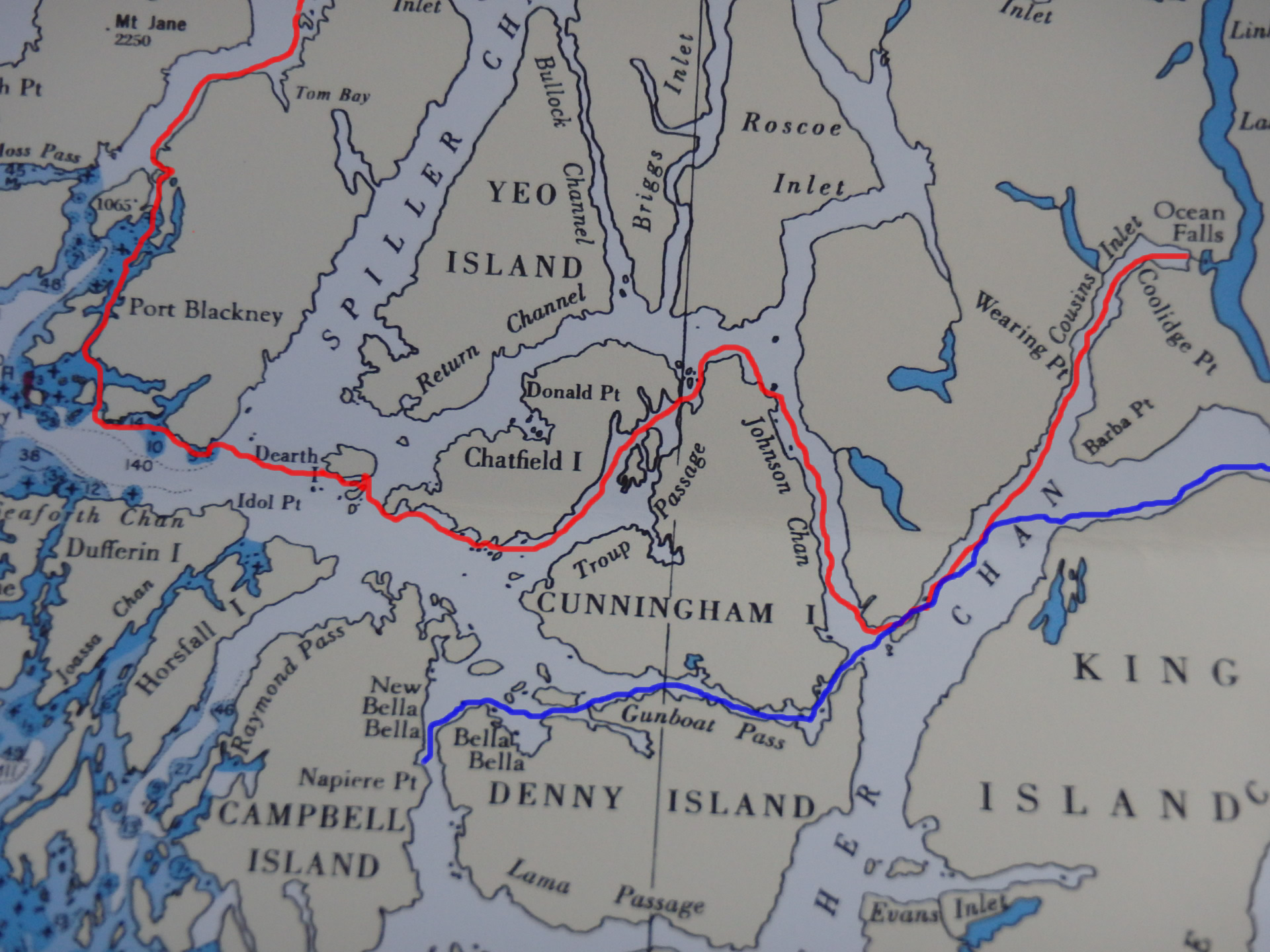
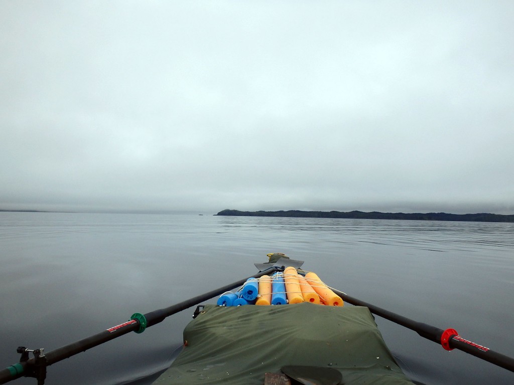
 Red shows my route leaving Ocean Falls. Blue shows the route previously taken on the paddle from the Bella Bella ferry terminal to Bella Coola. The weather was good leaving Ocean Falls and I was able to row until I reached the east side of Cunningham Island. There I thought it best to play it safe and switch back to paddling as the winds were picking up. When rowing, I’m seated in the centre of the canoe and my centre of balance is higher and it is not possible to change back to paddling without going ashore. Rowing is for fair weather only but hopefully, I’m able to do a bit of both each day.
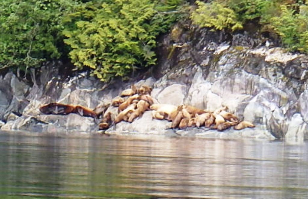 A stack of sea lions in Johnson Channel. I didn’t try and get close to them as I figured they’d have the ‘please do not disturb’ sign hanging. I enjoyed listening to their constant barking bawls which carried across the water for a considerable distance.


I have a marine radio and was wanting to get the marine weather forecast from this cruise ship. After explaining who, what and where I was, all I got from them was something like ‘oh, I think conditions are supposed to get better’. I didn’t appreciate getting what I considered to be a brush-off. The marine weather was of utmost importance to me and here I thought was an opportunity to get it firsthand. There are no broadcasts of marine weather along much of the coast, which was a surprise to me. I did have my InReach device that allowed me to send and receive text messages and I had asked my sister to advise of any changes in the forecast.
This ship produced a considerable wave that I turned towards to meet head-on without any concern. Earlier though, when I was still ashore, an ex-navy destroyer-type ship passed, and with its higher speed and sharper bowline, it produced a wave I was glad I only had to observe from the beach.
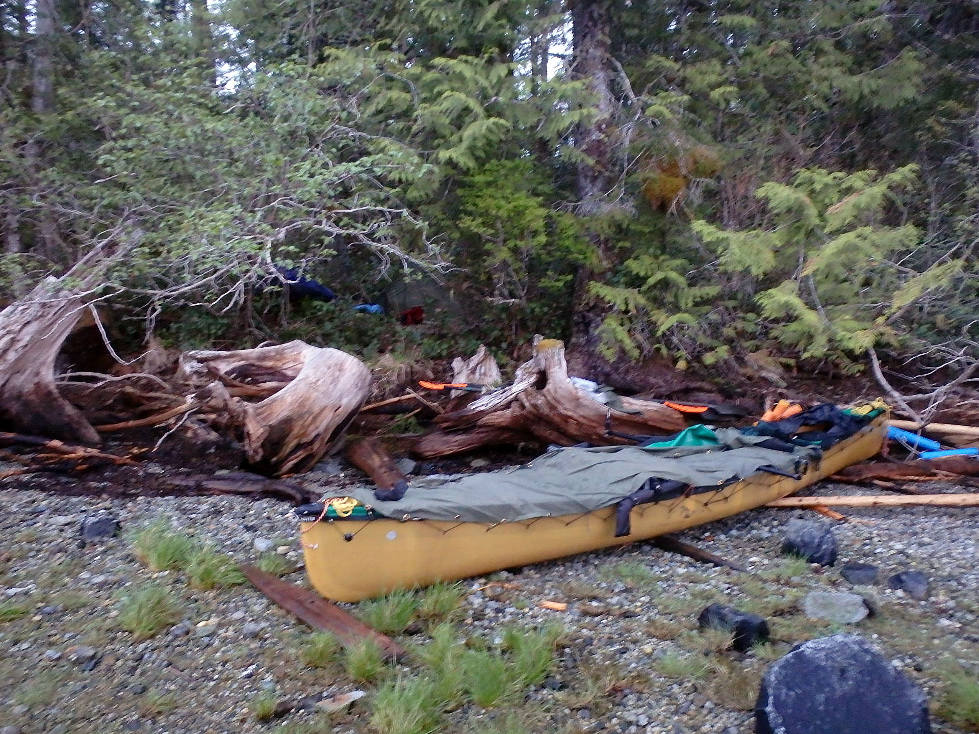
 One of a couple of places where the high ‘spring’ tides forced me to pitch the tent in the bush above the tide line. The ground vegetation along the coast is mostly thick salal, a heavy stemmed well-rooted low brush. It can’t be removed by simply pulling the stems out, it must be cut away. My gear included good quality long-handled lopping shears with the handles cut short. These worked very well for clearing a tent spot.
In preparation for the high tide, I pulled the canoe up onto a very large log that obviously hadn’t moved in some time and felt certain the canoe was secure. I was awakened by the sound of lapping water along with a thud thud I recognized as the canoe being battered by wave-driven wood. I spent the next hour protecting it as best I could. The log it had been perched on was afloat and it was not possible for me to pull the boat out of the tidal area. All I could do was fend off the debris surrounding it with a long pole. Eventually, the tide dropped and my sleep resumed.
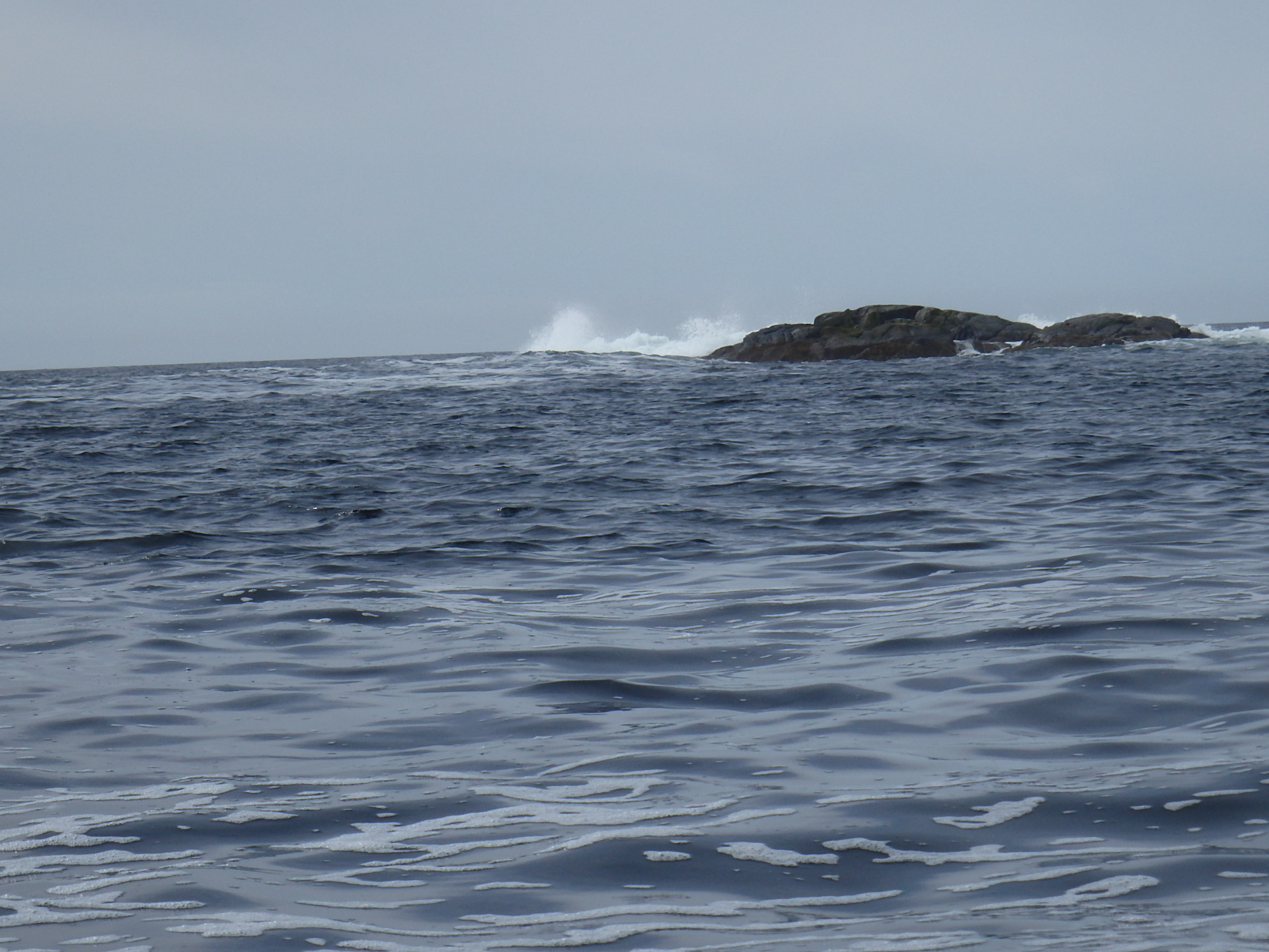
 Crossing Spiller Channel. This crossing was five kilometres and would require about fifty minutes in calm conditions. The strait ahead was open to the Pacific. I never liked these long crossings where conditions could change quickly. Sure enough, this serene scene changed halfway across when a headwind pushed the waves to white cap conditions. With this crossing as open as it was, I was concerned that things could quickly get much worse but the wave heights remained manageable although the crossing time was lengthened considerably. I don’t have any pictures of rough conditions as picture taking gets shelved when all hands are on the paddle.

 After crossing Spiller Channel, the next bay crossing presented another challenge. Thick fog! This was the only time I had to deal with fog. I was prepared, in that, I had practiced staying on course using the GPS alone. And if the GPS were to die you’d best have the compass handy with the correct bearing set. From losing sight of the landform behind me to seeing it loom ahead again, took only fifteen minutes. But it seemed a long fifteen minutes with no directional reference other than the GPS. Adding to that, off course to the left, was the open ocean. In reality, there was no reason for any concern, other than the fog, conditions were ideal with calm waters and no swell. I was grateful for the GPS technology. Gps allows you to home in on the destination waypoint. It continually corrects the bearing should there be any sideways drift due to currents. Not so for a compass bearing, where uncorrected drift would make missing the target a certainty. Paddling into a fog void is eerie.
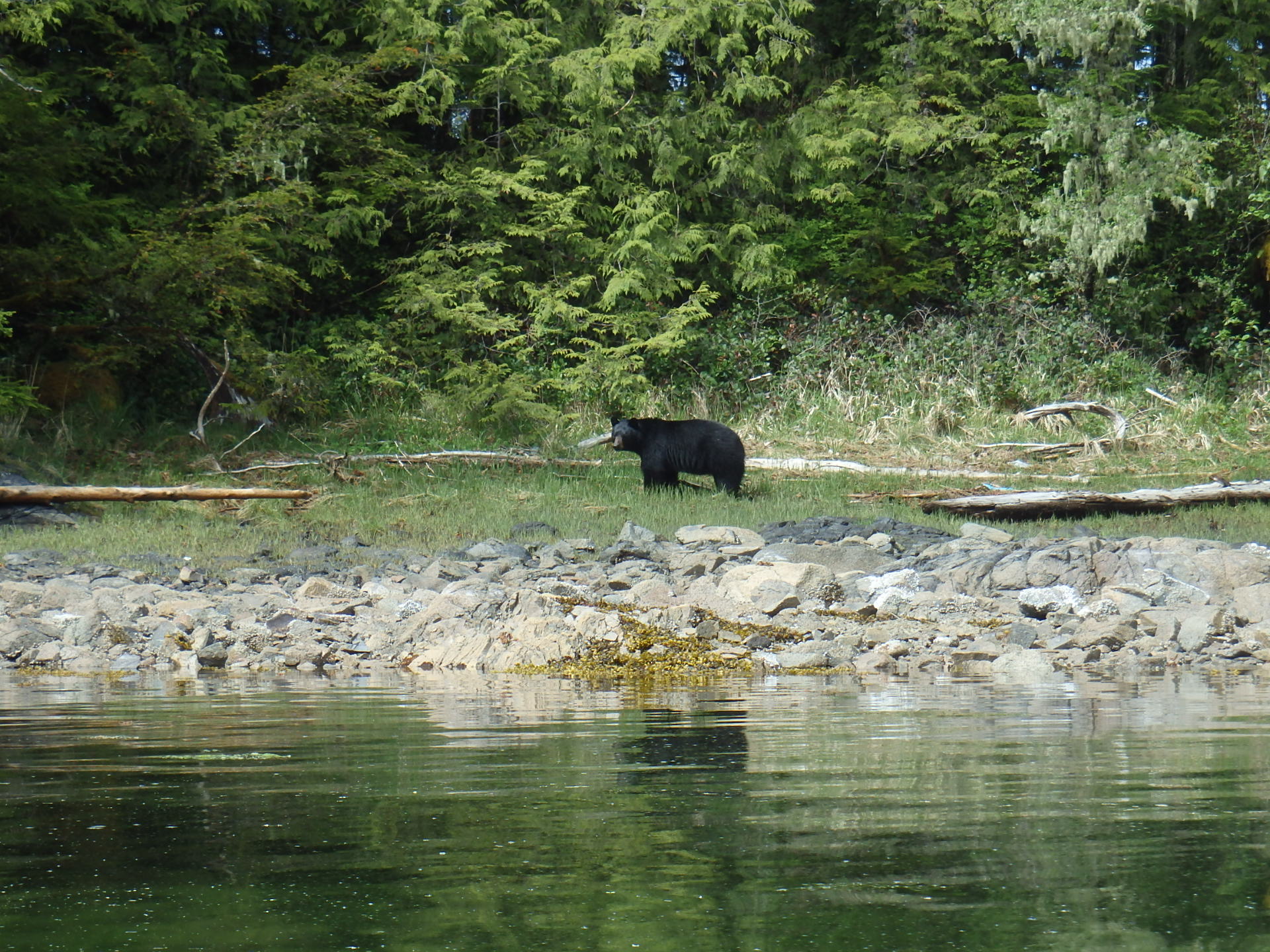
 A Watch Island black bear. Here my course changed from west to north and I was shielded from the swell of the open ocean by this island. This was short-lived, with one more open water inlet to cross, before I finally reached Reid Passage. There I made my first landing of the day, thankful to be in quiet waters.
Once through Reid Passage the open ocean again presented itself. This time with more swell than earlier in the day. Once I relaxed, I enjoyed the crossing – somewhat. This would be my last time looking at the open Pacific and I wouldn’t miss it one bit.
 My route didn’t offer much in the scenic category. Waterfalls were rare. I also expected I’d be seeing some nice stands of old-growth timber but that wasn’t the case. That puzzled me as a temperate climate, with its long growing season, and plenty of water should make for great annual tree growth.
 Why do the trees grow poorly? There is no soil! This is a slough, where everything has let go and slid into the chuck. It’s a wonder trees can grow at all with the bedrock so close to the surface. I saw evidence of much larger sloughs in various stages of regrowth.

A sea urchin. I was paddling beside a sheer rock wall and noticed it attached there just in reach of my paddle, thanks to the extra low tide. They have become a big problem on the Pacific coast. They chew through bull kelp stems and destroy kelp forests. Sea otters eat them and where there are sea otters, the kelp thrives. People eat urchins too but not enough to keep them in check.
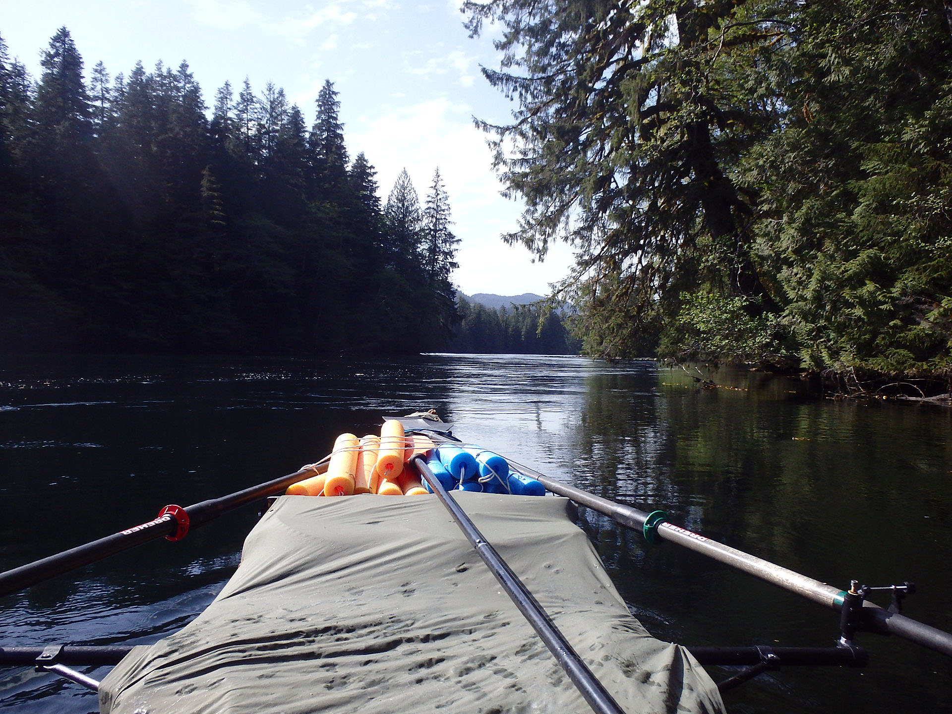
 Not a river but very narrow Griffin Passage. When I arrived the current was running against me faster than I could paddle. I had to wait at least an hour before being able to slowly make progress.
 Camping in the rough, and another spot where I had to manufacture a tent spot in the bush.
 Back out into the true ‘Inside Passage’ of the B.C. coast, and just in time to see the Port Hardy – Prince Rupert BC Ferry pass. For most of my route, I chose to not use the main shipping route.


My ‘navigation orders’ should anyone want to know my route.
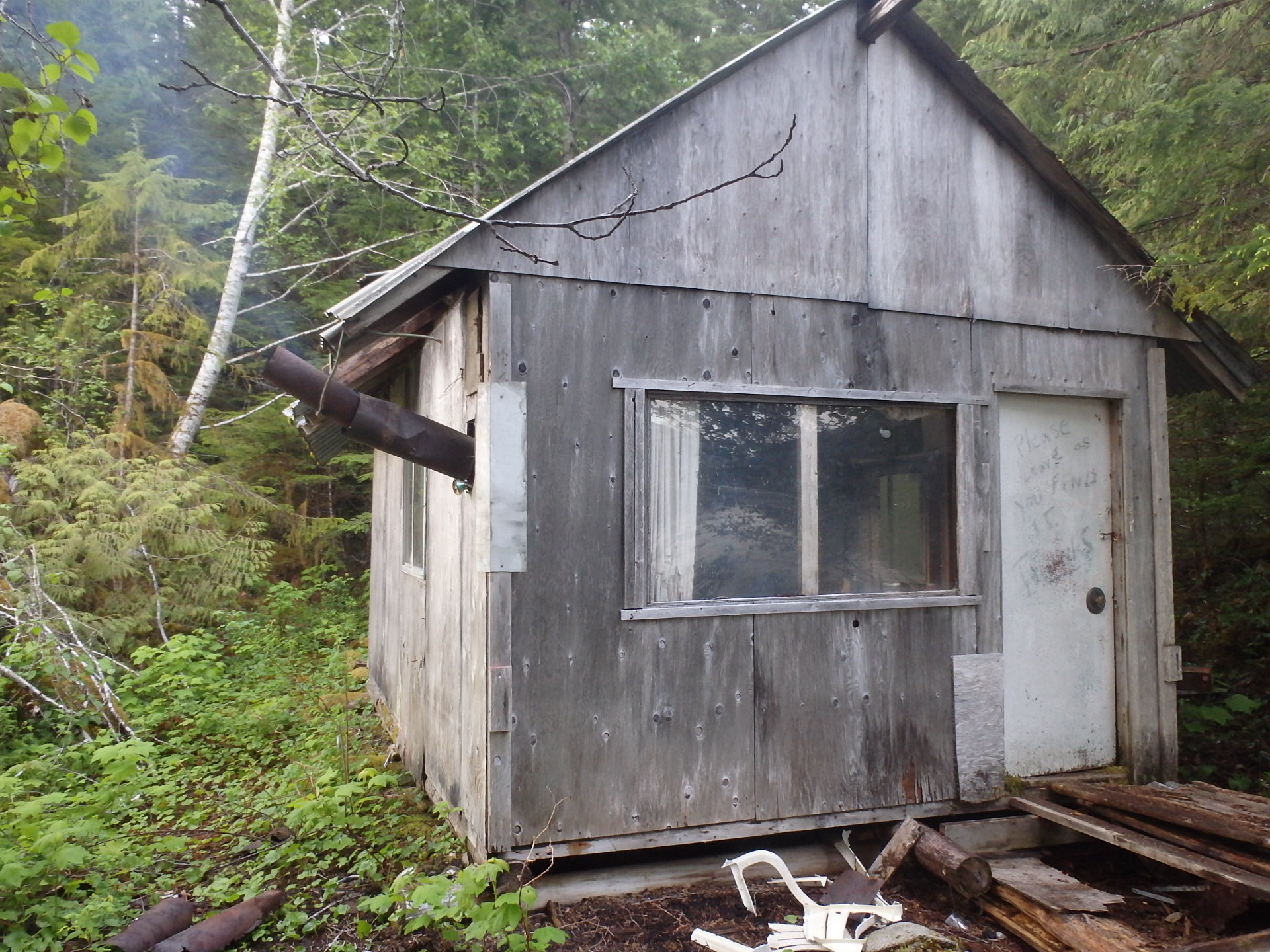
 Took some scrounging and fiddling to piece together a workable stove pipe on this old cabin but oh how nice to have some drying heat on a damp day.
 Wet heat is nice too! Spent two days enjoying the Bishop Bay hot springs while enjoying the company of other boaters. The first people I had seen in eight days.
