| July 3/13 to July 12/13 | Kinbasket Lake |
| July 12/13 to July 28/13 | Valemount to 108 Mile Ranch |
| August 25/13 to Sept 9/13 | 108 Mile Ranch to Bella Coola |
This portion involved cycling to Clearwater, then paddling the Thompson River and Kamloops Lake to Savona, and then cycling to my sister’s at 108 Mile Ranch.
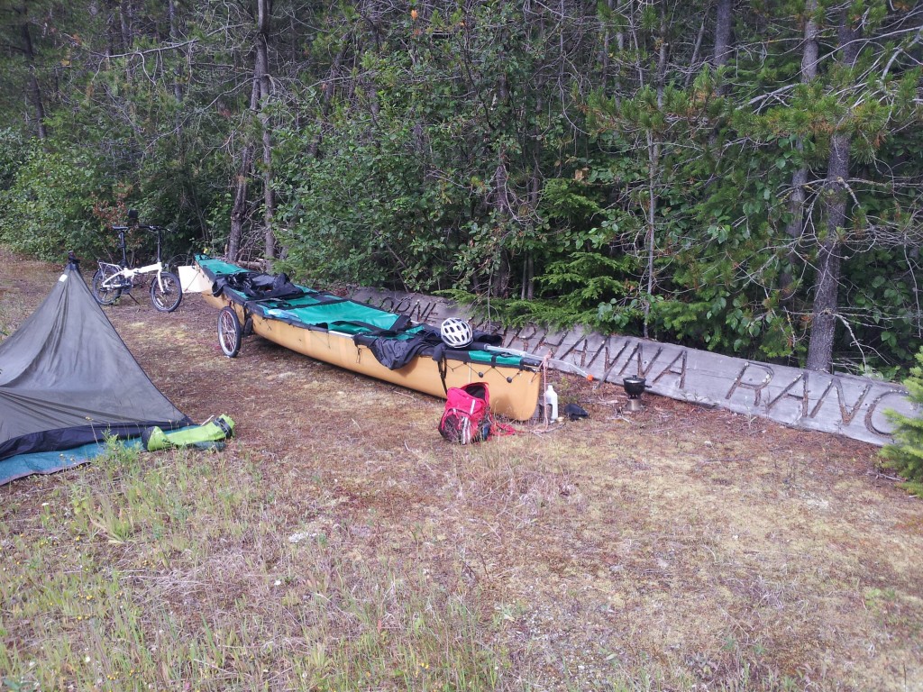
Valemount to Clearwater is a nice bike ride. Traffic on Highway 5 was moderate with few uphill grades. Even the watershed divide between the Columbia and Fraser rivers is a minor elevation rise. I camped at this spot, not realizing until the next morning’s downhill ride, that I was camped right on the divide. This was the first and only time on the entire trip that I used some bug repellent. I wonder what stories from the past are represented by the old ranch entrance log.

My first look at the Thompson River where it crosses Highway 5.

Stumbled onto a geocache at my second nights camp spot. Didn’t take anything, but signed the book and left a bike spoke.

There are two narrows on this portion of the Thompson. This is the upper rapid and there is no trail to this location. I hiked down from the highway and then a kilometre and a half downriver to the lower rapid. That rapid, called Little Hell’s Gate’ has a road to it and an observation platform. I doubt that voyageurs using the Thompson would have portaged either of these rapids. That’s a huckleberry bush in the foreground and the ripe berries on similar bushes slowed down my trek considerably.

The stop at my cousin’s in Clearwater included a drive to have a look at the waterfalls in Wells Gray Park. Helmcken Falls, on the Murtle River, is the fourth highest in Canada.

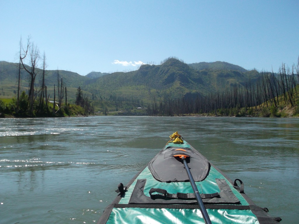
My camera was idle when it came to finding what I considered to be scenic shots on the Thompson. The snow and glacier-capped mountains above Kinbasket Lake had spoiled me. Figure this one made the grade though.

This sheep (it’s there, keep looking) can thank me for its survival although it was capable of saving itself. It had fallen from the pasture down onto the river’s edge and had likely been there a couple of days ( judging by how it had grazed the fallen grassy banks down to putting green height) when I noticed it. I alerted the farmer and when we approached to try to catch it, it jumped two and a half feet back to the pasture. He commented on the stupidity of sheep. If they are being herded into a pen with a low bar across the entrance and the first sheep jumps the bar, all the others will jump too, even after the bar is removed.
A nice camp spot at the mouth of the Barriere River, just upriver from the town. Nice until a wedding party started up at one of only two houses on the hillside across the river. Plenty loud but it didn’t keep me awake.

It’s my solar panel, sitting in the only spot that had some sun, the morning after the loud party night. Tucked away there, I forgot about it and left it behind. I was likely 20 kilometres downstream when I remembered it. That had me ditching the canoe, walking to the highway, and sticking out my thumb to retrieve it. Interesting conversations with the two fellows that picked me up for my two, there and back rides. One told me of Fridtjof_Nansen who in the 1890s, intentionally froze his ship, the Fram, in the Arctic pack ice, in an attempt to see if the ice would carry it to the North Pole. The other described canoeing in crystal clear, Murtle Lake, in Wells Gray Park.
Starting down the canyon below Barriere. This is the area of the 2003 McLure fire that burned 26,000 hectares and many homes. Here the drop in elevation of the river ahead became noticeable.

There are two sets of rapids on the Thompson between Clearwater and Kamloops. Neither are significant but they had this newbie to whitewater, in his less than nimble canoe, apprehensive. The first is called Fishtrap Rapids and they were more, fast water on a steeper grade, than rapids. My GPS was reading 17 kph going through those. Above are the rapids near Heffley Creek … I took the far channel, not as quick a decent but I had to be on my toes all the same.

A doe and fawn leave the river at my approach. The picture also shows the erosion caused by the North Thompson. Not of monetary significance here but certainly so to the farms along the river. Pastureland is continually being lost to the river which likely amounts to hundreds of hectares every high water year.

The confluence of the North and South Thompson Rivers, east of Kamloops. I certainly took the long way around to get here! From Vernon, I could have cycled north to Enderby and canoed down the Shuswap River to Shuswap Lake and the South Thompson. That trip might have taken a week at the very most. Interesting too, that like it is between Valemount and Avola, there is practically no elevation divide between the waters that flow south through the Okanagan to the Columbia River, and the waters that flow north to the Thompson and Fraser River.
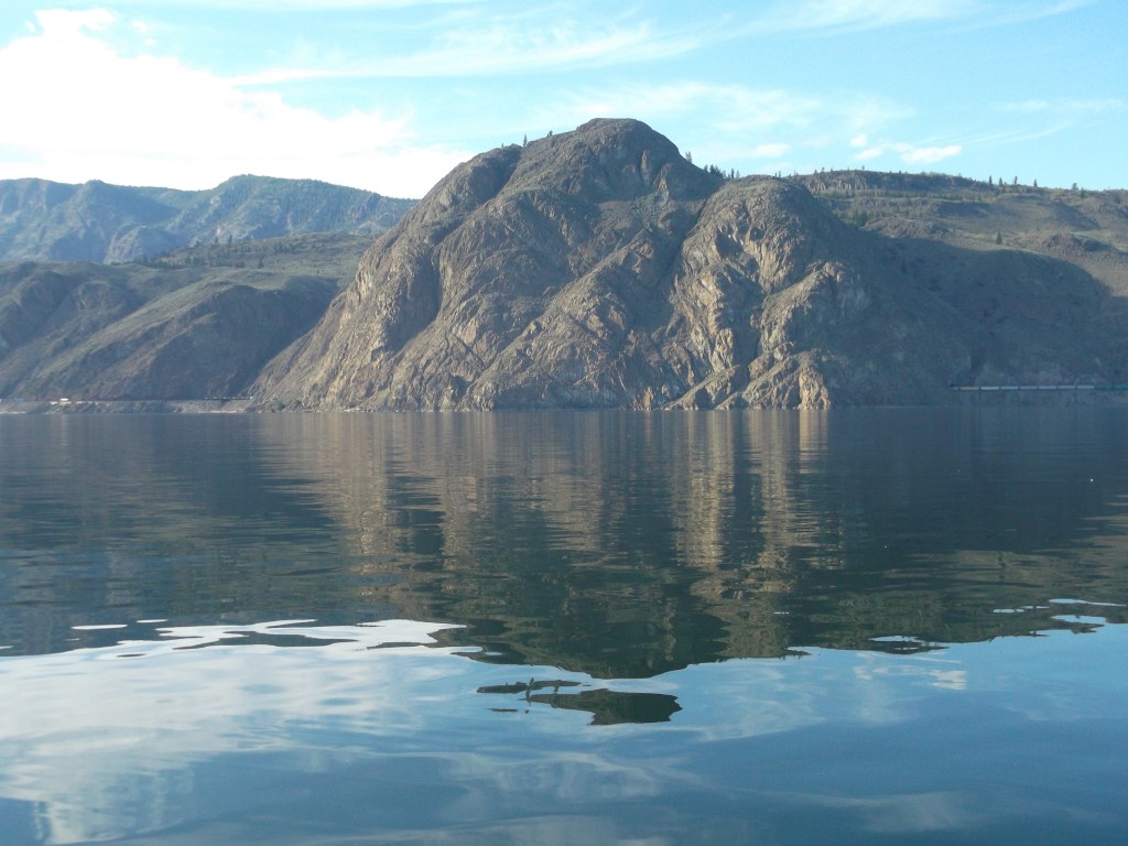
After a few days at a cousin’s in Kamloops, I continued downriver to Kamloops Lake. Look close and you’ll see a train passing through this lump of rock.

Clay cliffs above Kamloops Lake. While camped at this spot I did a CBC radio interview with Josh Pagé. Done by cell and the audio is not the best.
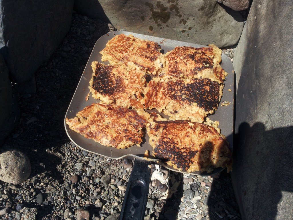
My pre-packaged ‘trail cake’ mix when it’s fried. I had made 400 pounds of it before leaving and left it with my sister, vacuum packed in twenty pound boxes, to send to me when required. It’s a healthy mix of my own design that includes rolled oats, flour, soy grits, whey, sugar, ground flax, oat bran, wheat germ, ground sunflower seed, raisins, and dried cranberries. Baking powder too and, when mixed a little thinner, and baked in an oven it makes a tasty cake.

North of Cache Creek, at Hat Creek, the Bonaparte band was having a powwow to honour a family member. Interesting, especially so, in that I sat next to a fellow from the Lummi band In Bellingham who explained a bit about the various dances and dress. Did you know that if an eagle feather falls from a costume there is a lengthy ritual before the feather is retrieved? This happened at this event and no pictures of the ceremony are allowed. In a competition, if an eagle feather falls from a costume the dancer is disqualified.
And on the subject of eagle feathers, in a book I read about David Thompson, he described how the Piegan natives caught eagles. They would dig a shallow hole to hide in and cover it with willow and grass. A piece of meat was placed beside the hole and when the eagle came for the meat the hunter would reach out and grab it by the legs. No doubt a few ‘badges of honour’ from those captures … including between the eyes I’d think.

This is Begbie Summit on the Cariboo Highway. But also in the picture, on the bluff to the right, is Begbie Mt. fire lookout. Very rare worldwide, I’d bet, that a major highway runs less than half a kilometre from a fire lookout said to have 100 mile 360 degree view. Reason being, the summit isn’t to a mountain pass, but to the Cariboo Plateau. It’s like gaining access to a huge tabletop.