| August 25/13 to Sept 9/13 | 108 Mile Ranch to Bella Coola |
| Sept 10/13 to Sept 18/13 | Port Hardy Port Alice Telegraph Cove |
| Sept 20/13 to Oct 10/13 | Zeballos Nootka Sound Kyuquot |
In planning where my travels would take me, Vancouver Island was included, but beyond getting there by ferry from Bella Coola to Port Hardy I didn’t have any route planned. I wanted to have a look at Nootka Sound as that was the location of the first British settlement on the coast, and was also where Spain agreed to secede its claims to BC to the British. Beyond that, the intention was to just follow my nose. Doing that, the first turn off the highway south, was the road to Port Alice.

The pulp mill town of Port Alice. Port Alice is a clean and quiet little town. The mill is not near the town. It produces a speciality pulp, using a different method than most BC pulp mills, and has been in operation since 1917. A method that doesn’t produce a smell like other pulp mills.

A perfect camp spot in Port Alice. Private yet just down the beach to a small park which even had an electrical outlet. I spent two days in Port Alice updating my journal at the local library. The bike ride to this west side of the Island included some 12% up hills and I thought I’d be seeing them again going out until someone suggested paddling to Coal Harbour.

The south entrance to Quatsino Narrows. Tides on the coast cause strong tidal currents wherever there are narrows. These currents can become like rapids on a major river when the flow is the strongest. The flow ceases when the tides are at their highest or lowest. Tide and current tables are necessary to determine when this slack tide is and how fast the current will be as the tidal change progresses. This was my first narrows and I arrived right at low tide and noticed no current at all. At its fastest, the currents through this narrows approach 7 knots or 13 kilometres per hour which is 6 clicks faster than I can paddle!

A bit of nature’s artwork on the way to Coal Harbour.
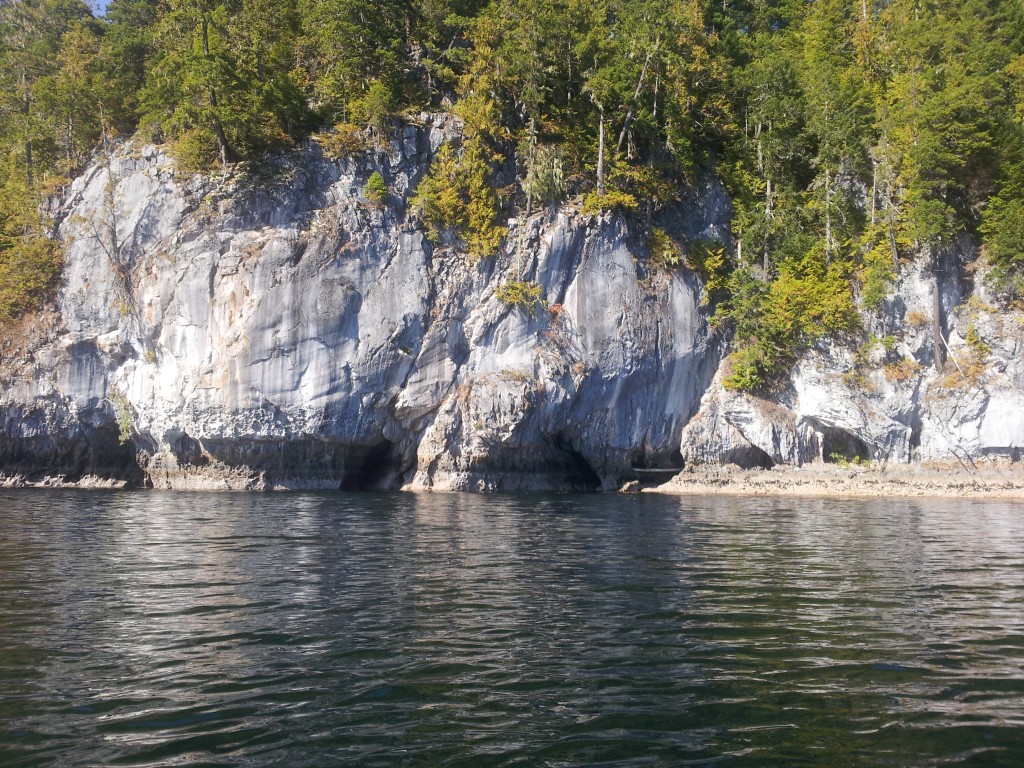
The slow but relentless grind of ocean vs rock.
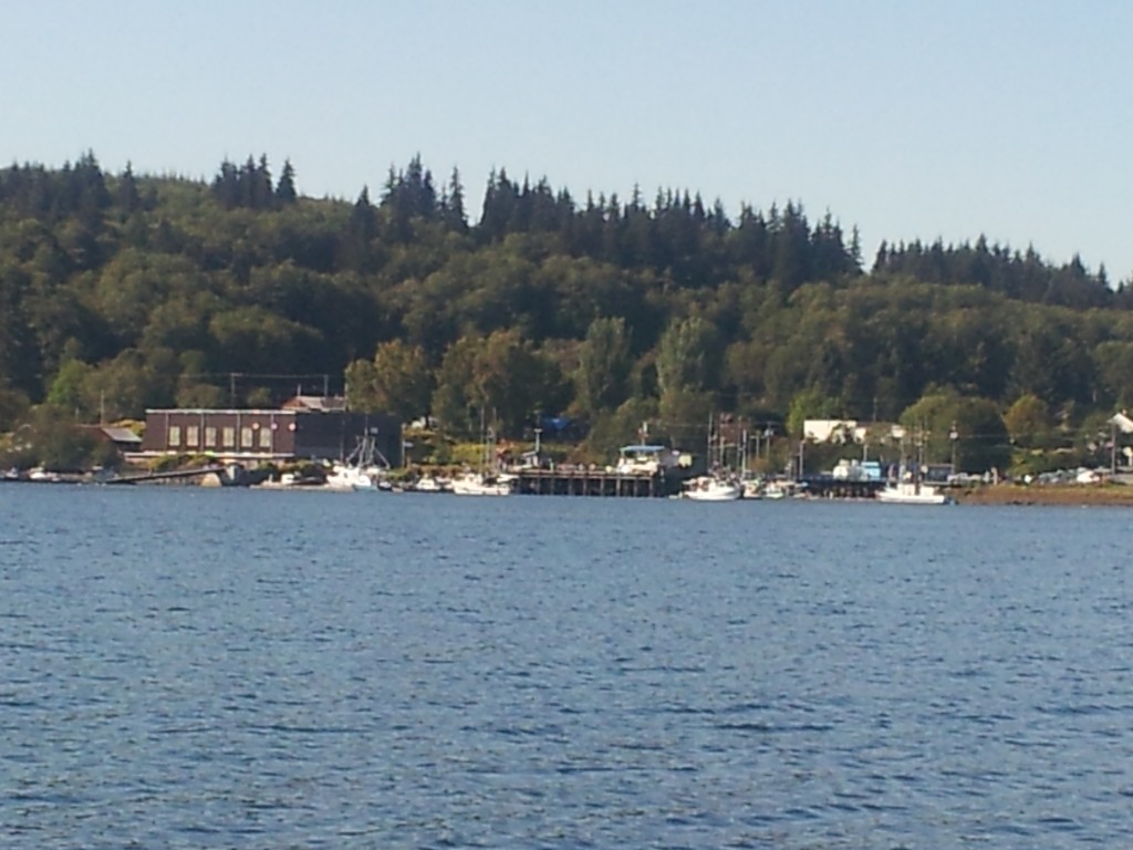
Coal Harbour. Lots of history here. The flat-roofed building on the left was an RCAF hanger during WWII and also served as a whaling station up until 1967.

Unloading ‘frozen at sea’ tuna at Coal Harbour.

Thanks to the couple who gave me this fabulous piece of coho. There was no need for concern about what to do with leftovers either.

There wasn’t too much above the tide line for decent camping spots so I chose this old wharf that was attached to an anchored, not in use, fish pen structure.

The harbour at Port McNeil. I biked out from Coal Harbour and that road joins the Island Highway only a few km south of Port Hardy so I had an hour or so of previously biked road on my way here. I arrived just before dark and found a suitable spot to camp undetected, just as I had on my arrival in both Port Hardy and Port Alice. Ditching an 18 foot canoe, as it’s getting dark, isn’t that difficult and I always camp on the premise that it’s better to beg forgiveness in the morning than to seek permission at night.

OK, this is embarrassing. Ocean skippers are supposed to know that the water goes up and down. I was in the library and did come back to check on it once. No harm done except for the bother of having to find wood to put under it before dragging it back afloat.

I was told of a good camping spot not too far from the harbour. However before I got there I met Norm at his place of solitude. He’s a McNeil resident but paddles his canoe to reach this home away from home when he can. Spent two very pleasant days enjoying Norm’s company and his retreat.

Sunset from Norm’s beach. This is Johnstone Strait and orca sightings are common enough but no such luck during my visit.

Breakfast for two. A chance to share some of my ‘trail cake’ mix with Norm.
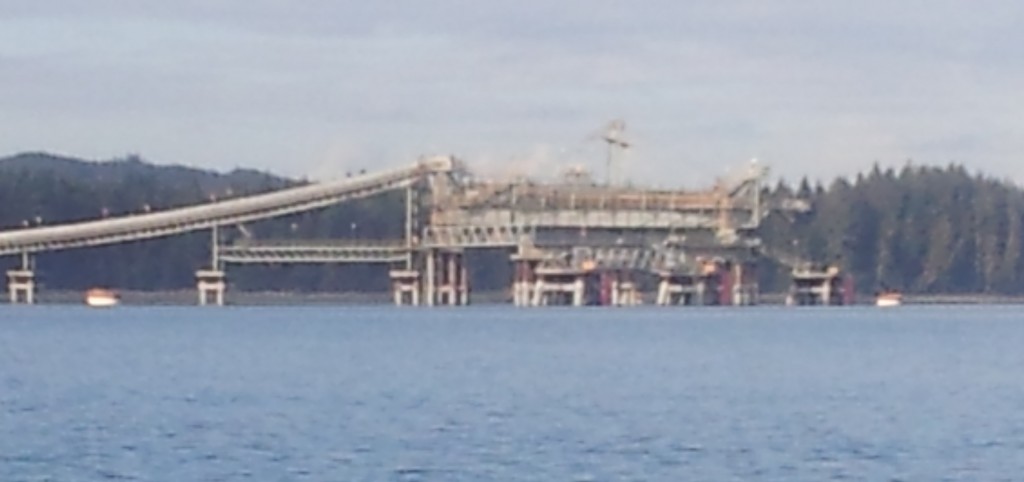
Cycling into Port McNeil I passed over a conveyor belt running under the highway and wondered what it was for. Would you believe that premium cement gravel is in such demand in California and New York that it’s being exported by the shipload?

Beachcombing bears – a sow and two cubs. They weren’t the most interesting part of my paddle from Port McNeil to Telegraph Cove, however. I followed the shoreline south and had been warned about the tidal currents in Weynton Passage south of Alert Bay. My timing was good and I was there right at the high slack tide. Learned later that this area is an anomaly, as a result of its location, and the time of high tide varies between nearby locations. The currents along the shore reminded me of the Columbia River at its swiftest. There were eddies and boils and the direction of the flow would change quickly depending on if you were in a back-eddy or not. Meanwhile, out a couple of hundred metres or so from the shore, it was like a washing machine. It was all white froth as far ahead as I could see and the clashing of all that water made a constant roaring noise as well. This lasted for nearly an hour. I wasn’t concerned about the water I was paddling in, as it wasn’t acting any different than it does in a large fast flowing river. But I was wary of the possibility of getting in a current that would take me out into the maelstrom and I hugged the shore as much as possible.
