PreviousNext
| June 18/13 to June 20/13 | Revelstoke to Invermere |
| June 28/13 to July 3/13 | Invermere to Kinbasket Lake |
| July 3/13 to July 12/13 | Kinbasket Lake |
From Invermere to Golden the Columbia is all Grade 1 and an easy and enjoyable paddle for anyone with some canoeing experience. Wildlife, from songbirds to elk, is abundant through the Columbia ‘wetlands’. Aptly named but even more so with the timing of my arrival. Recent heavy rains had the river at near flood conditions. Finding dry landing spots was a problem. At its current level, the valley is not one huge lake, the river banks are still defined by the trees and shrubs along the bank, but all of the banks were flooded by a foot or two of water, and nowhere in the river valley bottom is there anything that isn’t flooded. Once I was seven hours between dry landing spots. The river diverts into many channels. I preferred to take the channels on the west side furthest from the highway, when possible. Twice I had to turn and paddle upstream short distances as the too narrow chosen channel was blocked by debris. My GPS showed all the channels accurately. Below Golden the gradient and river flow rate increased and high water wasn’t a problem. Before Bluewater Creek, where I took out, to avoid the rapids in Redgrave Canyon, the river was flowing at roughly 10 kph.
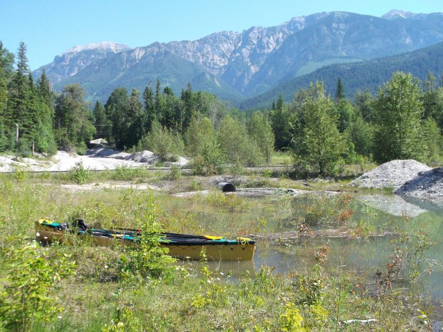
The Columbia Wetlands.

Looking back on Windemere Lake, leaving Invermere

I had been warned to watch for the railway bridges below Invermere. The current was too fast here to chance ducking through the passable space on the right side so I was going to play it safe and line the canoe under the bridge. However, a walk up the tracks revealed another bridge over an incoming creek, back upstream with a secondary channel that bypassed this location. An upstream paddle of a few hundred metres soon had me past this obstacle.

Except for the bird calls and vegetation, one might believe they are on a river somewhere in South America. A rare upstream paddle to navigate around the low railway bridge.

I don’t filter or chemically treat any of my drinking water but if it’s available I’d rather drink from a creek than a river. This handy little waterfall offered a ‘paddle up and fill up’ location. I was able to back into this spot and fill my water bottles without leaving the canoe.

A sudden splash and this cow elk was swimming the river in front of me to get back to her calf on the opposite shore. There were three calves with the two cows.

The King and His Court. Court jester perhaps in the case of this magpie figuring he had as much right to this lofty perch as did his majesty.

Perched eagles were frequent. Looked up in time once to see one just before it hit the water in a fishing dive. The splash sounded like a cannonball. It came to the surface without a fish and after a few circles returned to the same perch to try again.

As I paddled downstream I noticed, in the distance, two ‘somethings’ moving quickly along a log and entering the water. I was far enough away when they spotted me that I couldn’t be sure what they were. I paddled faster to catch up with them and realized they were a pair of geese intent on leading me on a ‘wild goose chase’ away from their nest. I have never seen a Canada goose act and do as this goose did. (I assume it was the goose displaying this trickery but it may have been the gander.) As I gained on them she separated from the gander and swam over to the shore. Suddenly there was a great splash and she disappeared. I had the thought that perhaps a sturgeon had made a meal of her. I looked towards the gander and there was another splash and she reappeared beside him. She had dived and swam underwater like a loon a distance of at least fifty feet and unbelievably fast too. Then she again swam to the shore, and as I passed her this time, she began the antics shown in the picture. She stretched out her neck and held her head as low to the water as possible. This wasn’t to make herself invisible to me, if she wanted to do that she could have just turned and disappeared into the bushes. She wanted me to believe that she thought she was hidden – all a part of her decoy act. After swimming downstream in this manner for a short distance she suddenly turned about and swam upstream with the same body position. By this time we were likely half a kilometer from the nest. The gander continued to swim downstream ahead of me for a time but then took flight and returned upstream also.
On the following day, I startled another Canada goose with three goslings. She swam downstream while uttering a short honk every second or so. The goslings all dove and swam upstream underwater, reappearing all spread apart from one another.
Sly or cunning fox we say, well equally so for the geese it appears.

Your chance for reasonably priced waterfront property on the bayou! Fishing at your doorstep. Possibly even boat in boat out at times!
Extra scenic to be paddling at sunset but not the intent – I was still looking for somewhere dry to pull out and camp. Here the steep rocky grade up to the railway, all along the eastern shoreline, offered no such exit.

I had no other choice than to stop at this small private dock and spend the night on what was obviously private property across the tracks. I did, however, locate and have coffee with the owners in the morning.
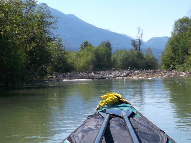
This channel was blocked by debris. This happened twice but each time the upstream paddle to find a new route was easy and short.

Going backward through a small opening out of the blocked river channel. Small-sized debris had to be moved before the canoe could access the exit route out of the channel and into the wetlands. The material was moved (set adrift) using the paddle and without exiting the canoe.
McKeeman Creek at Castledale. A nice camping spot. Anyone wanting to canoe the Upper Columbia should plan on stopping here. It’s a very rare dry location among all the wetlands.

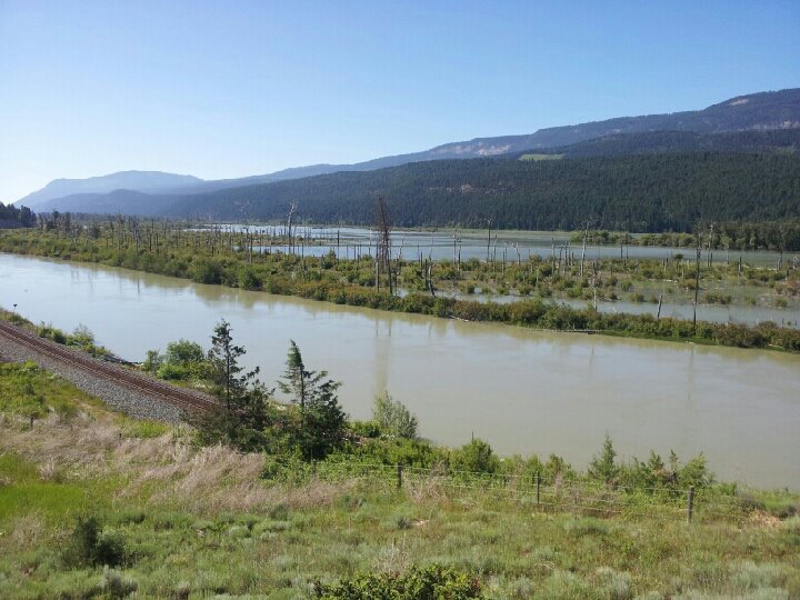
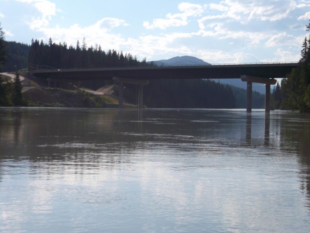
A bridge at Golden. This one I was able to reach up and touch as I passed under. Below Golden, the valley narrows, and the river grade increases. The deciduous shrubs and trees of the wetlands are replaced by coniferous stands of pine and fir.
Crossing my previously biked path on the Trans Canada Highway.
My last camp spot on the Columbia downstream from the CPR station of Donald. What had been a lazy old river was perking up quickly here. With video this picture would show a large and constant whirlpool across at the opposite bank. My GPS showed a light effort paddling speed of 15 kph. Bluewater Creek enters the Columbia downstream about 300 metres from this location. I knew I would have to exit the river there and portage around the last five kilometres of river to Kinbasket Lake, to avoid the rapids in Redgrave Canyon.
The next morning I made the short run downstream to this creek. Bluewater creek would be running very fast and although I expected there should be a good back-eddy (as there usually is) at the upstream side of the junction I thought it best to have a look before entering the mouth of the creek. I pulled the canoe to the shore where the current was slower, wanting to find a place where I could at least tie the canoe while I inspected the creek. I did manage to stop the canoe and hang onto some vegetation but then decided that some overhanging tree branches just downstream a couple of boat lengths offered a better spot. This was a big mistake that almost had me in the water with the boat capsized. I know well that any ‘sweepers’ are deadly to a canoe. Those being any overhanging obstacle that could block the free flow of the boat. When this happens, with the boat parallel to the obstruction, the top of the boat is held stationary while the current continues to push against the bottom. The result is the boat tips, and it is not possible to hold the boat to prevent it from tipping. I didn’t see these branches as being such an obstacle though. They weren’t touching the water and they didn’t look strong enough to hold back the canoe. I also had expected that I’d be able to keep the canoe from swinging parallel to them. Right away though, as I started to drift towards them, the boat did swing parallel and I was in a struggle to prevent the boat from capsizing, as the canoe came up against the branches. My first action was to try to pull away from the shore into open water. This attempt only lasted a fraction of a minute but at one point the boat was tipped so much that the water was right up to the spray skirt covered gunnel. Very trying moments, trying to hold the canoe from tipping more, while seeing it tipped so much that without the spray skirt water would have been flooding over the gunnels. At one point I let go of the kayak paddle and was lucky to be able to grab it again before it was out of reach. I thought I was not going to be able to prevent a capsize. Then I quickly changed my tactic to one of pushing up on the branches and this worked. I was forced under them and the canoe was free again. This had me at the mouth of the fast-flowing creek and the expected back-eddy that allowed me to easily paddle to shore. That was a very close call. If I had capsized I’m confident that I would have had no problem getting myself ashore. But I doubt that I would have been able to prevent the canoe from going down the canyon and had that happened I don’t expect I would have ever seen any of it again. As it was the only loss was my hat! The gain was the knowledge of never making that same stupid mistake again. I refer to my close calls with a one to ten rating of what I call my ‘degree of concern’. This episode at Bluewater Creek ranks as the highest for my entire journey, a 9 out of 10.

Taking out at Bluewater Creek. I was relieved to see the road a kilometre or so up from the mouth of the creek. The banks were walkable and I thought I could simply pull the canoe up the fast-flowing creek. I found this difficult, however, both because of the current, and also because the canoe was rubbing along the gravelly bank. This was also making a mess as the loose gravel was falling onto the spray skirt. Further upstream I spotted some trapped debris that sufficed as a natural ramp and provided a means to pull the canoe out of the water. Scouting about soon found a nearby quad trail and I didn’t have too far to go before I could assemble the bike and cart and push everything to the road.
The picture shows how fast the creek is flowing. When I entered the creek from the river I was on the opposite bank. To access the road I had to be on this side, and that meant paddling across the creek. Those were tense moments too because I couldn’t be sure that my best paddling speed was sufficient to ferry me across the current before I was swept out into the river. Plenty of adrenaline certainly assisted that effort!

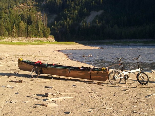
Loaded and rolling at Bluewater Creek. The abutments of a former bridge can be seen in the background and mark the location of the former Big Bend Highway bridge.

Hatless me on the road to Kinbasket Lake. This was once the Big Bend Highway which was replaced by the Rogers Pass Highway in the ’70s. Accessing Kinbasket made for a tough day. The river distance was only about five kilometres but the road distance was more like ten. There was a 150 metre elevation gain to overcome and on gravel, it’s necessary to push on grades that I’d be able to ride on pavement. It was a very warm day as well.

Obviously a big bore – perhaps a big boar?

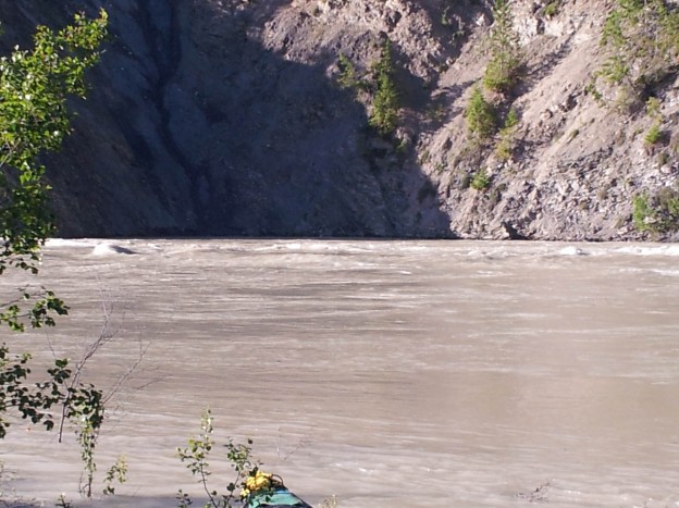
The beginnings of Kinbasket Lake. This is the water reservoir behind Mica Dam and the water level can vary by 150 feet annually. I was able to clear an old quad trail down to the shoreline and it wasn’t necessary to carry the canoe.

I walked up the shoreline to see what the river was like where it entered the lake. It’s not anything anybody would want to attempt in a canoe. This picture doesn’t show the size of the waves at all. I guesstimated them to be two metres in height at times and they came from all directions.

Getting down to the water.