The trip up the Arrow Lakes took eight days. If someone told me they were intending to make the same trip I’d be warning them about the lack of take-out places. (Uh I’m not referring to anything golden arch-like.) I was tested three times by the wind. The first time, I was able to reach a safe landing beach but that took more than an hour of intense paddling. The second time I was able to tuck into enough of lee but had no place to make a landing. Two conveniently placed stumps allowed me to hold fast with no danger to the canoe. The third time it was again a contest to reach the protection of the available bit of lee shore. A rocky shore there though prevented a landing and I was able to gain some experience in remaining stationary within a small space while keeping the bow to the oncoming waves.
Overall the lake was placid far more times than it was any kind of windy. It’s safe to travel as long as one has the time and patience to not be out there when weather conditions indicate winds are likely. Staying close to shore is a must and any crossings should be done before breakfast.
I was surprised by how warm the water was. I was expecting near frigid conditions but it was not uncomfortable to wade in and bath … did that twice Mom!
Leaving Syringa Park. The day started in Castlegar with an hour and a half bike ride to reach the boat launch. Met there, by cousins Donna and Dar, who helped get me water-bound. Donna admits, that when I was rowing away, she was wondering if she’d ever see me again.
Lunch break stop on first day up the lake. Syringa Provincial Park, my starting point, visible in the distance.
The community of Deer Park – no power poles here. Reason being – there’s no power.
Typical shorelines in areas where there is no place to get ashore. But this could change entirely over a period of time with a change in reservoir water level.
The best beach I could find at the end of day one. I did move rocks before hauling the canoe up.
My cookstove. It has a drop-in alcohol burner but can also burn wood, as it is here. It was replaced in the second year by a small hiker’s stove using iso-butane fuel. Finding fuel for those is difficult in Canada though. The one pound propane tanks are readily available but require a much larger stove. Fine for canoe use but too big for hiking.
No bugs and no chance of rain so a chance for premium star gazing and satellite observation.
Honeymoon on Arrow Lakes? Was tending my supper when I glanced down at the log I was sitting on and noticed this odd-shaped beetle approaching. After the photo op, I found them the room they needed.
But not always this serene.
Scouting out a too windy to travel lake. This is looking south with the wind from the north. I had just crossed from the east side when the wind picked up to white cap conditions. Even though I was adjacent to the west shoreline there was no decent place to make a landing but I was heading into a nice beach protected by the bluff this picture was taken from. It did take me an hour or better to make that safe harbour though. Oddly enough, on this uninhabited lake, there were two fellows on the shoreline, watching intently. As I paddled past them I hollered that I was doing fine. With the way the bow was being slammed into the wave troughs, I doubt they believed that until they saw me make my landing.
A lesson learned here too. I crossed the lake because of the angle the waves were hitting the shore. From that I assumed that the opposite shore would be in the lee of the wind. In fact the wind was pretty much straight down the lake but the wave pattern in such conditions is in the shape of a curve across the lake. It’s as if the waves closer to shore lag behind those further out. I had been duped, the far shore had the same winds as the one I’d left.
Morning at the second night’s camp spot. Arrived here with a strong north wind blowing and although not as strong, it continued as a headwind most of the third day.
Edgewood. I was looking for it but thought this was just a recreation area and the town was further up the lake. Was intending to walk into town. Didn’t realize my mistake until I saw the Needles ferry.
The Needles cable ferry. Thanks to the couple I approached in the line-up for passing along my message that all was well.
The Arrow Park cable ferry. Had a chat with the skipper (believe she was also crew and steward) and she mentioned that sometimes the waves on the lake come as high as the deck railing. That would be five feet! Also that BC Hydro was spilling water from the upstream dams. Her vehicle access ramps were going to become shorter and I should not camp too close to the shore.
Possibly the prettiest camping spot I found.
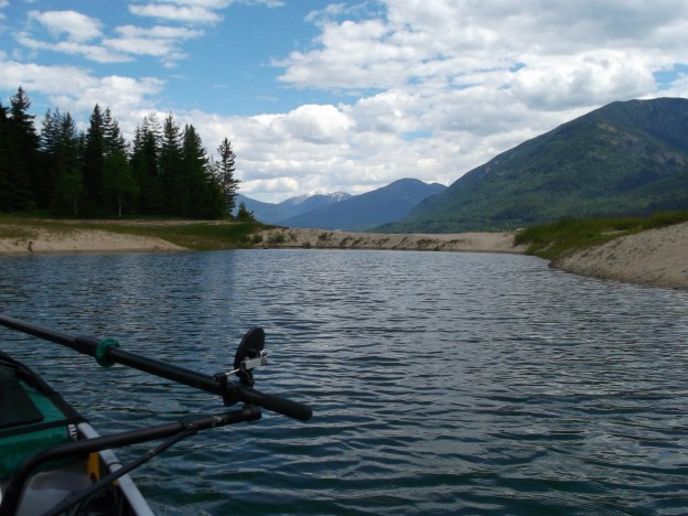
He took this one, a bit south of Nakusp, thinking ‘Wow look how narrow the lake is getting’! Then he paddled on to discover it’s a blind bay and he’d have to backtrack a half kilometre or so to proceed north. Recommend he fires the navigator!
Comment not needed eh.
After stopping for groceries in Nakusp I had calm waters and good rowing until about 7 PM. Then a tailwind came up. As this was the first time I’d rowed with a tailwind I was looking forward to the experience expecting easier and faster progress. However, I found it more and more difficult as the waves grew. You would expect that with the wind and waves quartering on your right side that you would have to be stronger with the oar on the left. Not so. I was having to put half again the effort into the right side oar than the left. Then things worsened as the wind became more westerly – like the waves in the picture show. Not white caps near shore but bigger than these remnants. There was no beach to land on and I was grateful when this one finally appeared. I made what I called a crash landing. No harm done but as soon as the stern touched shore and I stepped out a wave caught the bow and swung it hard onto the rocky shoreline. Plan B, if there had been no landing-place, and to prevent being washed into the rocks, would be to turn into the wind and ‘mark time’ with just enough rowing to keep the bow directly into the wind. That would always work as long as it didn’t get dark before the wind dropped!
After my ‘crash landing,’ I was looking around for the best place to pitch the tent. My eye caught sight of some log work further up the beach that didn’t look natural – a campfire site someone had been improving. Above that, I found this 8×8 foundation and slab floor. A ridge pole was all that was needed to provide a shelter with a great lake view.
Can you see what’s barely visible offshore in the middle of the picture? That’s a rock! A big rock right at water level. I didn’t notice it until I was ashore in this small bay. When rowing, my forward visibility comes from five inch convex mirrors attached to the oarlocks. They help keep me on course but don’t show things like floating debris well enough. For that, I occasionally turn so I can look forward.
None but the brave! And that certainly didn’t include me!
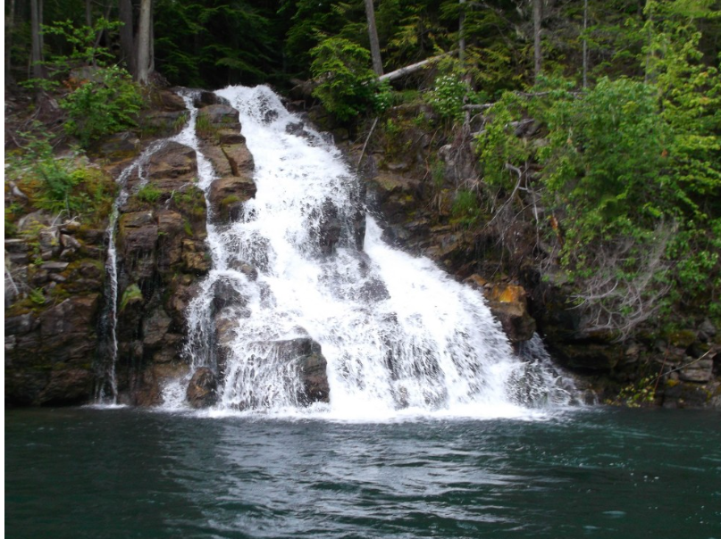
Just around the corner in the background of the diving log picture. Not visible at all from the lake but there was no doubt of its existence from its roar.
What fuels me – aka galley slave swill. The likes of 9-grain cereal, oatmeal, ground flax, oat bran, wheat germ, dates, raisins, brown sugar, and for this batch, molasses.
Two very conveniently placed stumps. This was the second time the wind had me in overdrive to reach a lee shore. Arriving I found no place to land but these two stumps were in deep enough water and acted like bumpers to keep the canoe from hitting the rocks. The bigger one had a handhold root that allowed me to hold fast. Held on like that for an hour and a half until things settled down.
Iron rails for getting something into the lake. This is the only evidence I saw of former industry along the lake.
The wind is picking up and just in time a usable landing spot appears.
Siesta time (under the tarp) while waiting out the approaching rain shower. I was feeling rather smug here as I foresaw the blow coming and was ashore with everything covered up just as the wind and rain started. Thought I’d won the contest for this day but it was just warming up for what was to come.
The wind has calmed now but the lake was in a real state of froth for a time. This was my third wind test in as many days.
This was the best shore offered. Useable if the wind had switched more to onshore making a landing necessary but likely the canoe would have suffered some deep scratches at best. I chose instead to wait out the blow afloat, ‘marking time’ by keeping the bow to the wind, while remaining stationary, as much as possible, using the kayak paddle.
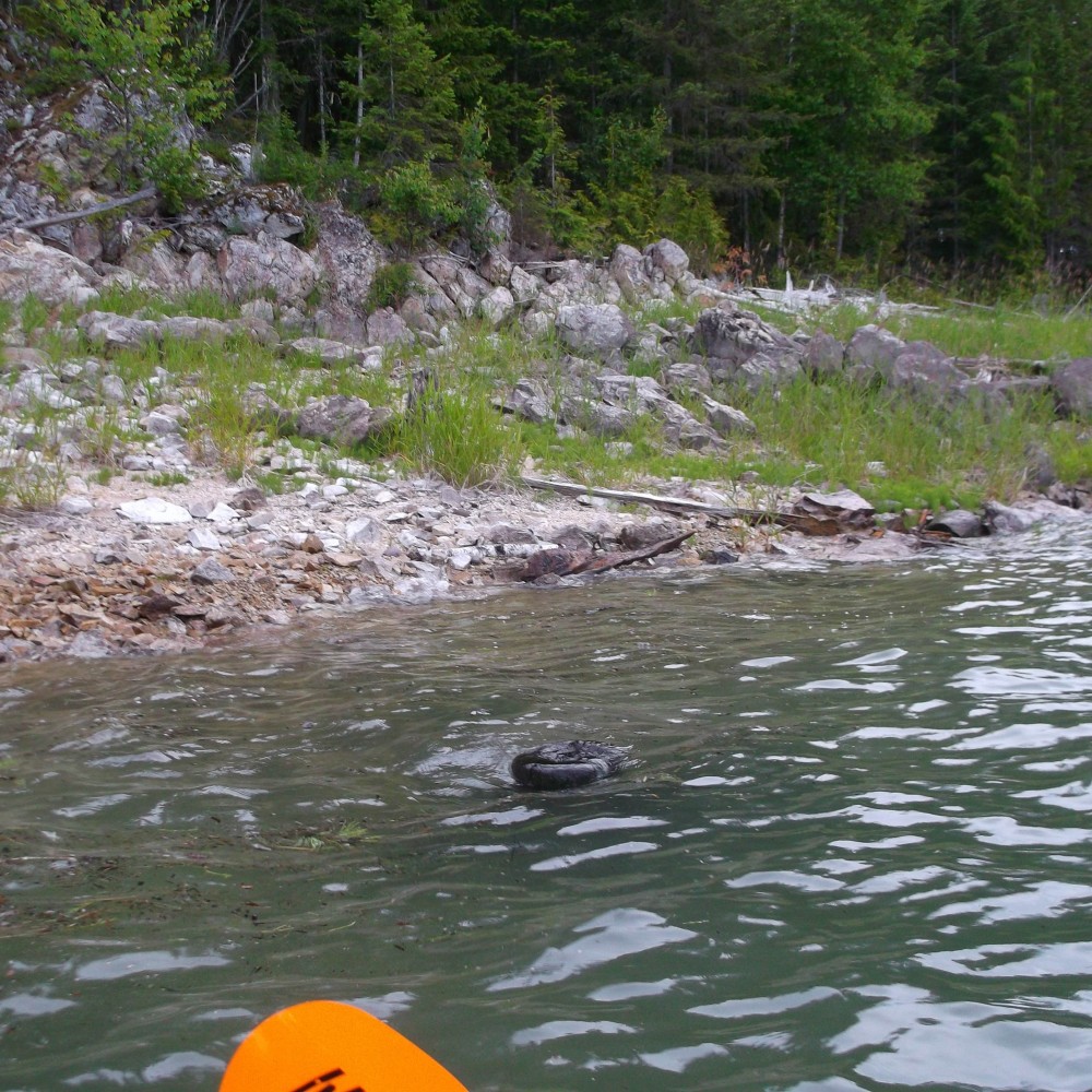
It’s a basking rock whale … or is it a whale rock? When I first passed, there wasn’t a ripple but I had to back up for the picture and my ripples spoiled the effect some.
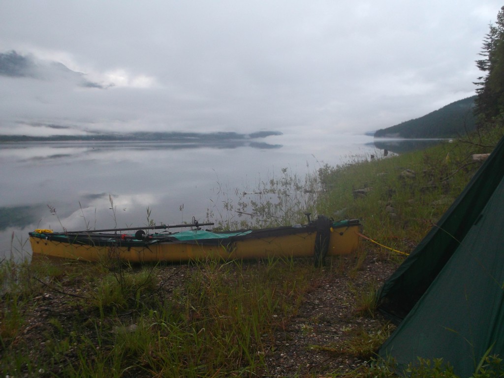
The morning following overnight rain. The clouds and ground fog hung around for most of the day which was great as it made for wind worry-free passage.
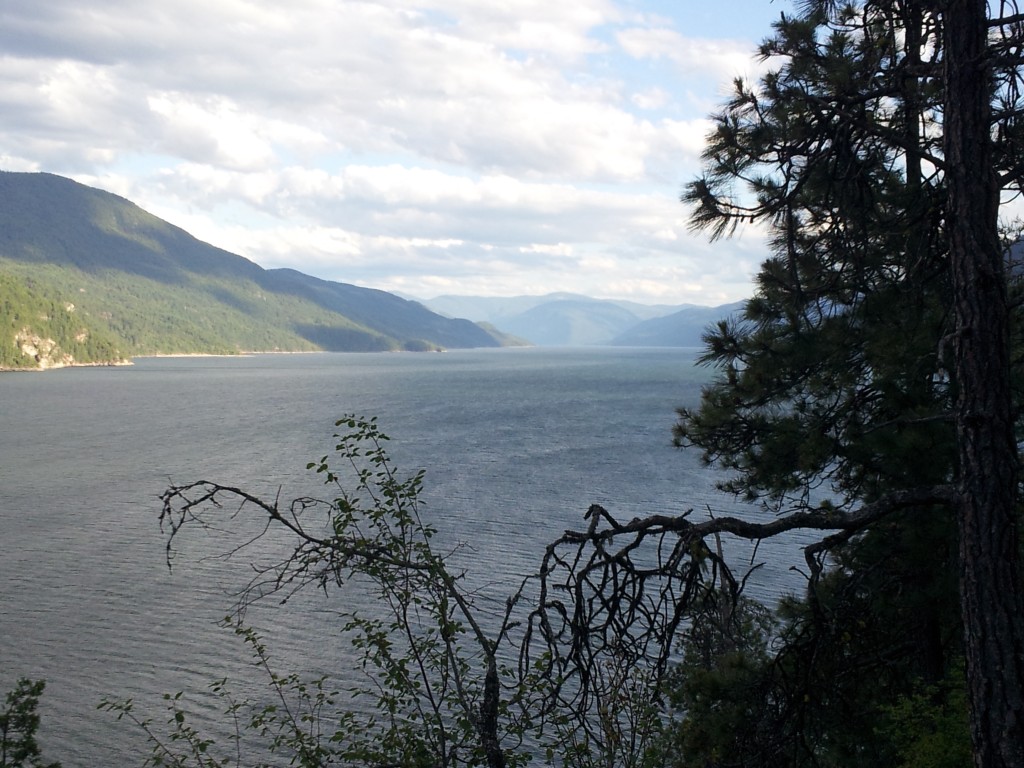
Facing south saying adieu to the broad ribbon of long straight stretches of the Arrow Lakes. From here north things narrowed and became more wide-river like.
Revelstoke Mountain Resort
My prescribed landing point in Revelstoke. Had no doubts I was in the right place. Spent two nights here.


